The Corinth Canal, an ancient boat slipway, a castle, an archaeological site and a museum were fascinating stops during our daytrip in the Corinth area of the Peloponnese
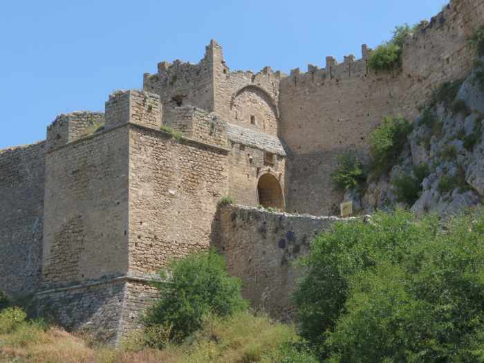
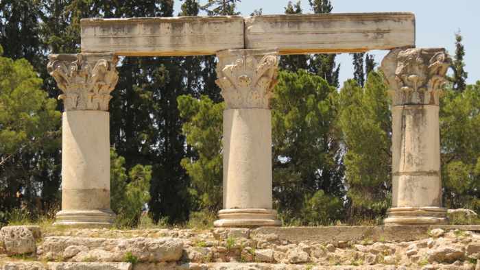
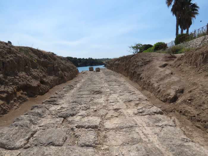
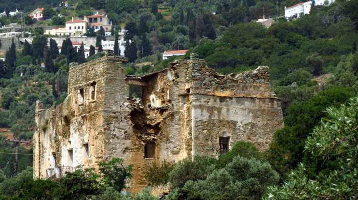
In less than half a day, we were able to visit such important historic sites as the Acrocorinth castle, top, the Ancient Corinth archaeological site and museum, center, and the Diolkos boat trackway at the western entrance to the Corinth Canal
Ideal for history buffs: During our short stay in Loutraki last May, we got to step thousands of years back in time with an easy daytrip visit to several of the premier historic attractions in the nearby Corinth area.
It was an ideal itinerary for history buffs as well as anyone who appreciates marvels of architecture and engineering.
Our driving route took us across a submersible bridge at the northern mouth of the Corinth Canal, where we stopped to see the Diolkos, an ancient track that was used to transfer boats overland from the Gulf of Corinth to the Saronic Gulf, long before the canal was constructed.
Next stop was the Acrocorinth Castle, where we wandered around the inside of the massive mountaintop fortress and enjoyed superlative views of the Corinth region.
Lunch and a coffee break in the modern city of Corinth topped off our tour of amazing feats of engineering and impressive monuments and artefacts from centuries of Greek history.
I have written individual posts to show photos and information about the attractions at each of our stops. You can view them simply by continuing to scroll down the blog, or by clicking on any of the following links to access a specific article:
A look at two unique places where visitors to Loutraki can sunbathe, swim and enjoy beautiful scenery within a 20 kilometer drive of the city
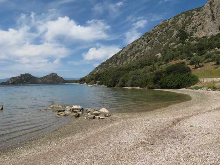
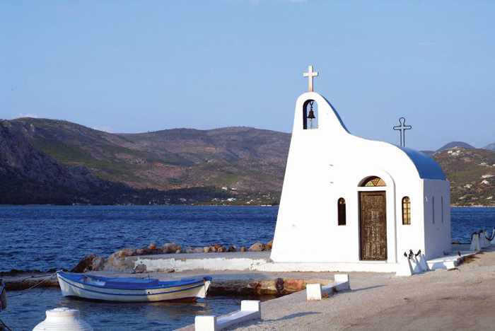
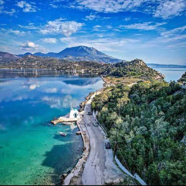
Encircled by pine forests, Vouliagmeni Lake is a salt-water lagoon where visitors can swim and sunbathe on sandy beaches and enjoy refreshments at tavernas along the shore.
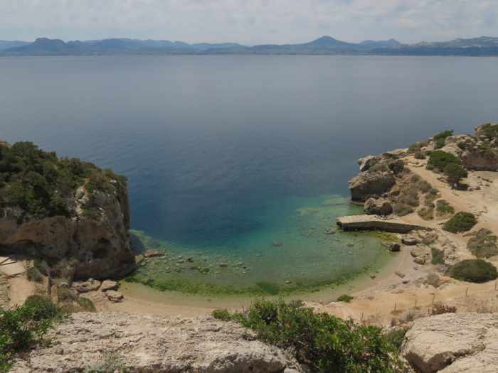
At the Sanctuary of Hera, visitors can explore an archaeological site, swim and cliff jump at a small beach below the ruins, then watch the sunset from a 125-year-old stone lighthouse perched high above the Gulf of Corinth
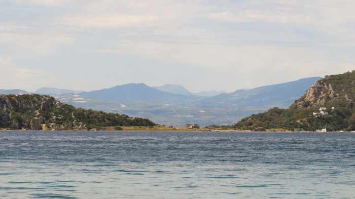
Into the Corinthian countryside: Sunshine, light clouds and temperatures in the mid-20s Celsius prevailed on our first full day in Loutraki in May. It was perfect weather for a drive through the Gulf of Corinth countryside to visit two of the area’s noteworthy attractions, Vouliagmeni Lake and the Sanctuary of Hera.
First stop was Vouliagmeni Lake, about 15 kilometers from the city. (Like many places in Greece, it is known and referred to by a variety of names, including Limni Vouliagmeni, Lake Ireon, the Heraion Lagoon, and the Blue Lake. To add to possible confusion, there’s another beautiful body of water named Vouliagmeni Lake that is also well-known by Greeks and tourists alike; that one is situated on the Athens Riviera.)
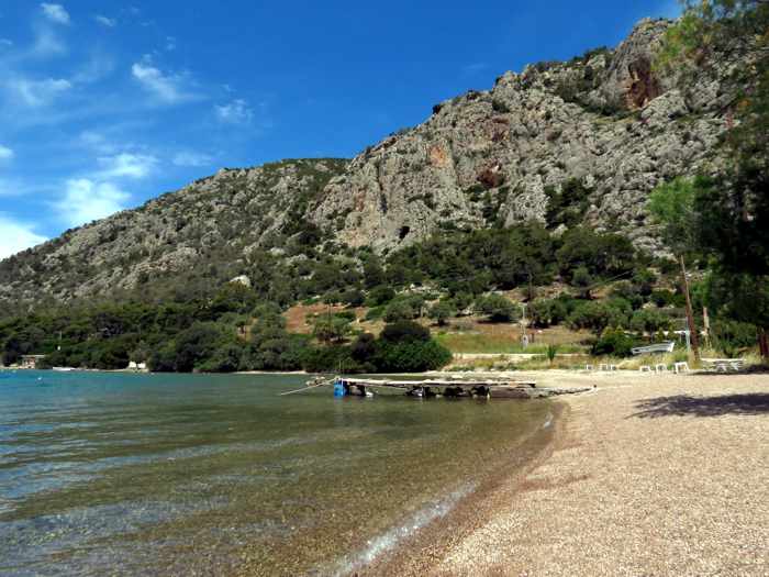
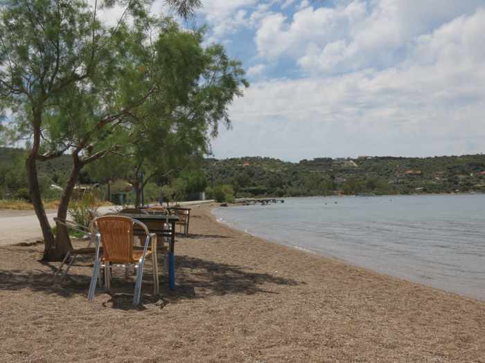
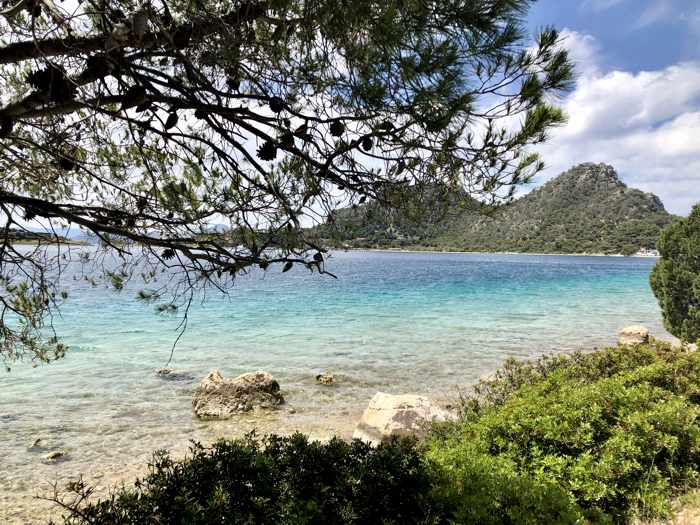
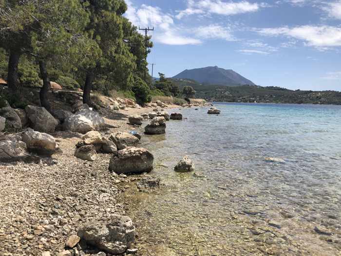
Surrounded by pine tree forests, rolling hills and steep rock slopes, the Vouliagmeni near Loutraki is an oblong-shaped salt-water lagoon connected to the Gulf of Corinth by a narrow channel. The lake is roughly two kilometers long and 1 kilometer wide, and its waters reach depths up to 40 meters. With sandy beaches extending across shallow stretches of its shore, and several tavernas and beach cafes located at varying points on the lakefront, it’s quite a popular daytrip destination for people seeking relaxation or fun in the summer sun — seasonal activities such as snorkeling, water skiing and wakeboarding, as well as cycling and hiking tours, are available at the lake.
Surprisingly, few other people were around when we were there, though that may have been because it was a Tuesday morning, and since we spent most of our time walking around and sitting in the sun on the northeast shore, near Taverna Hera, one of the lake’s handful of restaurant venues. There may have been more people at beachfronts on the southwest shore around Ypanema Seaside Food & Drink, or near the picturesque blue and white waterside chapel dedicated to Agios Nikolaos. Still, there was barely any traffic in the area, so it was remarkably quiet.
Above, photos we shot from the lakeside near Taverna Hera
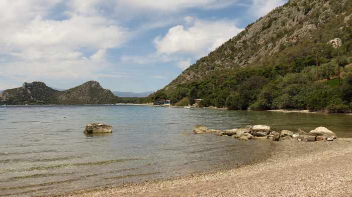
Above, three views from the lake’s north shore
Above, two photos of the charming Agios Nikolaos chapel on the shore of Vouliagmeni Lake. The images were shared on the social media pages for Ypanema Food and Drinks, one of the lake’s top beach venues. More photos of the lake and the restaurant’s beachfront facilities can be seen on the @ypanemaloutraki page on Instagram.
This aerial film by Dronetube_GR runs nearly 4 minutes and tours viewers above the lake, its beaches and the channel to the gulf
Please click on the link below to read about our visit to the Sanctuary of Hera on page 2.
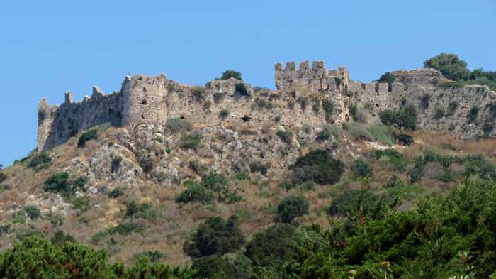
Walls on the southern side of Palaiokastro, the Old Castle of Navarino, which was built in 1278 near the town of Pylos in the Peloponnese
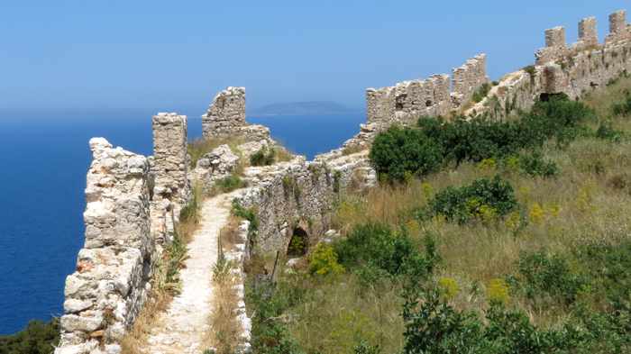
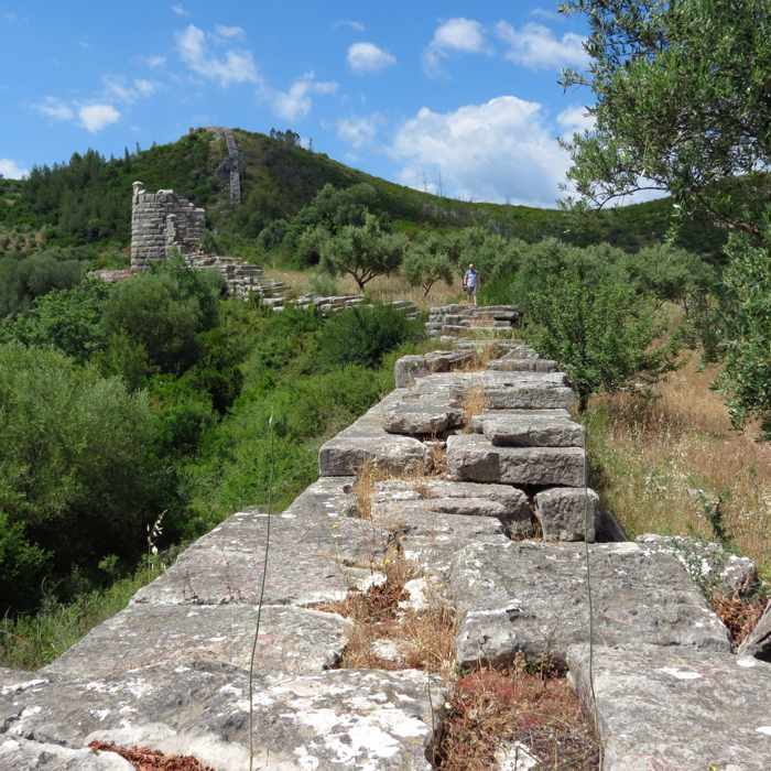
Though parts of the castle walls have collapsed, you can walk atop some of the remaining sections, such as this one high above the Ionian Sea
Walking inside the walls can be difficult — even perilous in places — if you stray off the main trail or try to take a shortcut from the west wall to the east, as we did. The castle’s south yard is overgrown with shrubs and prickly bushes, and the ground is covered with loose rocks and stones that wobble and roll underfoot.
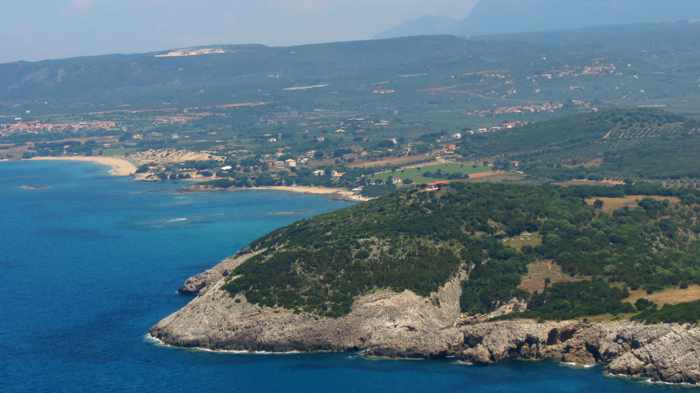
The big payoff for those people who make it all the way up to the northeastern corner of the castle: The incredible views of the Ionian Sea, Navarino Bay and the beautiful Messenian coast …
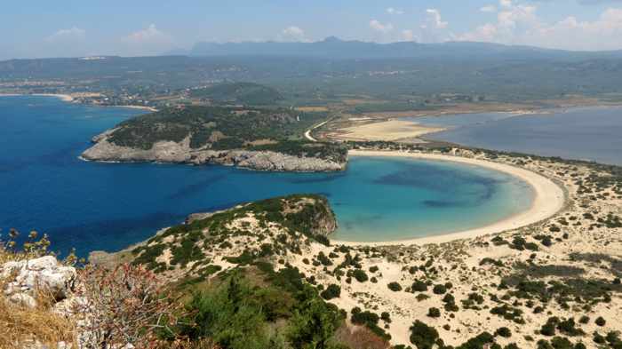
… and, most impressive of all, the stunning Voidokilia beach
Scenic trek: Built 740 years ago, the Palaiokastro / Old Castle of Navarino is certainly showing its age.
Its hilltop exposure to the elements, plus hundreds of years of neglect, have taken a severe toll. The outer walls are crumbling — some sections have collapsed, while others appear ready to tumble anytime — and only ruins remain of the buildings that once stood inside. Those structures have been reduced to rubble; the former walls and foundations are now boulders, stones and rocks scattered across the ground. The two castle yards are almost entirely overgrown with shrubs, prickly plants, tall grasses and trees that obscure most of the fortress’s interior. It’s possible to walk on some of the outer walls, and dirt paths wind through parts of the grounds, but it can be dangerous to step off the main trails — the rocks underfoot tend to shift and wobble as you walk over them, so there’s a constant risk of slipping and falling or twisting an ankle.
Because of the ancient castle’s derelict condition, plus the ever-present possibility of loose stonework falling from its weathered walls, the Palaiokastro is supposed to be out of bounds to visitors. There’s no fencing to keep anyone out, and no security guards to stop people from entering — just a solitary sign warning that “The Castle of Navarino is closed due to serious danger.” But that doesn’t deter thousands of tourists from visiting the site every year.
For most, it’s the breathtaking “must see” views that attract them — especially the castle’s unrivalled vantage points for photographing the incomparable and immensely Instagrammable Voidokilia beach.
That’s the main reason why I climbed up to Palaiokastro during our trip through the Peloponnese in May 2017 — I wanted to experience, in-person, the outstanding Voidokilia beach views that had fascinated me in many travel photographs and videos I had seen over the years.
[adToAppearHere]
To be honest, I didn’t know the castle was closed, and I also didn’t see the “danger” sign at the bottom of the access path. (My hiking companions did, but they never mentioned it.) I had read about Palaiokastro on a few travel websites, and knew that it consists mainly of defensive walls enclosing crumbled ruins, but none of the articles had said anything about the castle being closed or possibly dangerous to visit. Some sites even described it as a not-to-be-missed historical attraction. I figured it would take some effort to reach, since it’s situated atop a craggy hill a few hundred meters high. But once up top, I expected that it would be relatively easy to walk around, like the marvellous Methoni Castle which we had visited just the day before (see my post: A walkabout in Messenia’s 800-year-old Methoni Castle for an account of that.) So when we found the castle access path at the northwest end of Divari beach, I was eager to head up for a look around.
To continue reading and to see more photos of Palaiokastro, please click on the link under the video below to turn to page 2.
This video by AllMessinia takes you on a short flight above Palaiokastro, while subtitles provide historical information about the monument
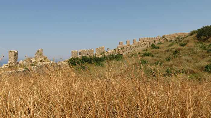
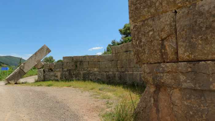
A segment of the 9.5-kilometer-long stone wall that was built in 369 BC to protect the ancient city of Messini. We walked sections of the circuit wall between three of its lookout towers.
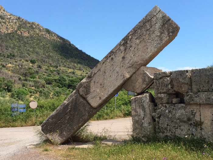
The circuit wall was built with two gates — one on the east side of Ancient Messini and one on the west. This toppled stone lintel is a striking sight at the western portal known as the Arcadian Gate.
The Arcadian Gate has two entrances, each at opposite ends of a large circular courtyard. This is a view of one of the curved walls inside the courtyard.
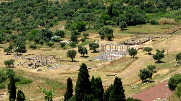
Part of the extensive archaeological grounds at Ancient Messini, which is described as “one of the most important cities of antiquity” in a listing on the UNESCO World Heritage Sites webpage.
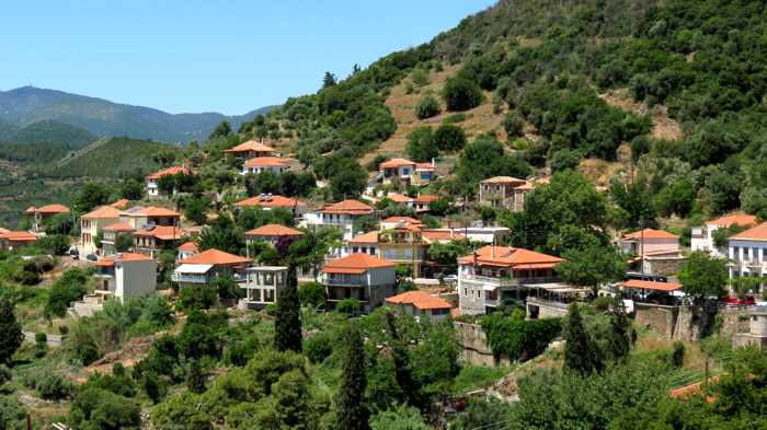
Mavromati is a small village that overlooks Ancient Messini from the lower slopes of Mount Ithomi. We stayed here for one night during our brief visit to the area in May.
Wall walking: Suffering from jet lag and lack of sleep after a 9.5-hour overnight flight to Athens, we didn’t expect to see or do much during the first day of our vacation in the western Peloponnese region of Greece in late May. We definitely didn’t anticipate walking around a village and historic sites for a few hours in hot temperatures and blazing sunshine. But since we had less than 24 hours to see Ancient Messini, we resisted the urge to take a nap in our hotel room, choosing instead to explore as much of the area as we could while our energy and enthusiasm lasted.
Our early afternoon arrival gave us an opportunity to wander the quiet streets of Mavromati village, admire the unique design of the Arcadian Gate, walk along sections of a two thousand year old fortification wall, view parts of the Ancient Messini archaeological site, see an historic monastery, and enjoy the fresh air and countryside before tucking into a delicious Greek dinner at a taverna near our hotel. We didn’t have enough time or stamina to visit all of the area’s fascinating attractions, but we enjoyed everything that we did get to see — and loved every minute of being back in Greece.
Please continue reading on page 2, where you’ll see more photos of the impressive Arcadian Gate, circuit wall, and Ancient Messini.
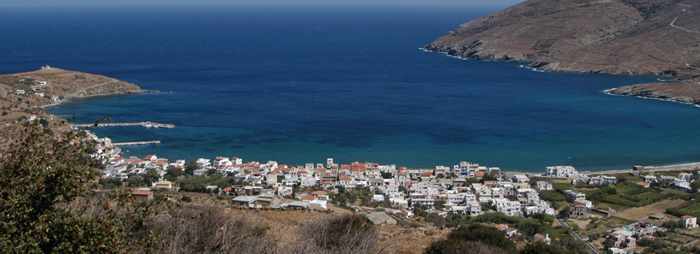
Korthi Bay and the village of Ormos Korthiou are seen in a photo from the Andros travel and information website Island Andros.
Quick peek: Have you ever experienced that nagging feeling, while travelling from one scheduled holiday destination to the next, that you’re missing out on some really worthwhile sights and attractions you simply don’t have time to stop and visit along the way? We certainly did during our trip to Andros last spring.
After spending 3 nights in Andros Town at the beginning of our vacation, it was time to move on. Our friends had to return to Athens, and they agreed to drop us off at our next stop — a hotel near the resort area of Batsi, on the northwest coast of Andros — while they drove to Gavrio port to catch their ferry back to the mainland.
So that we could all see a little more of Andros during the drive, we avoided the most direct highway route from Andros Town to Batsi and detoured to the south, following a highway that winds through the island’s Korthi region. The plan was to stop at the fishing harbour and seaside village of Ormos Korthiou to have a coffee before resuming the drive to Batsi.
Click here or on the link under the next photo to turn to page 2 of this post, where you can continue reading about Korthi and view more pictures of some of its top attractions.
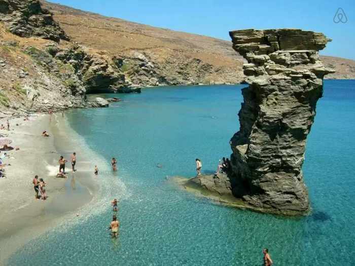
One of the iconic sights we didn’t get to see in Korthi was Tis Grias to Pidima beach (also called Old Lady’s Leap), shown in this photo from airbnb.gr. Pictures of the sandy beach and its towering stone pillar can be found on scores of postcards, websites and travel publications for Andros.
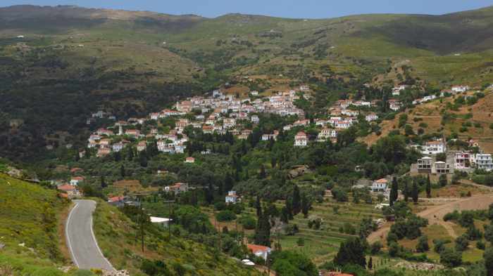
Approaching the Stenies mountainside settlement on Andros island
Valley village: There is much to see in the mountain and valley areas near Andros Town (also called Chora) on Andros Island. In fact, visitors could easily spend several days sightseeing and exploring the surrounding countryside by car or, if they prefer, by foot (the island boasts a network of nearly two dozen sign-posted walking and hiking trails, several of which start in or near Chora).
Unfortunately, we didn’t have that much exploration time at our disposal. During the first two days we stayed at Andros Town in late May, we spent much of our time in and around Chora itself. But on our third (and final) day, we ventured a little further off to do some hillside hiking in Stenies village and vicinity.
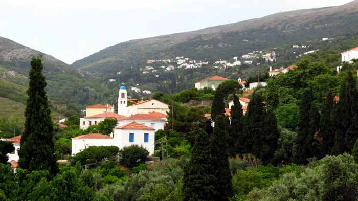
At Stenies, visitors can stroll past churches, red-roofed houses and palatial private villas nestled against verdant valley hillsides …
… and see historic ruins, including the crumbling Bistis-Mouvelas tower house, which dates from the 17th Century
Situated less than a 20-minute drive from Andros Town, Stenies is a residential settlement area that stretches across rolling hillsides in a mountain valley verdant with flowers, greenery and towering Cyprus trees. Blue-domed churches and large houses with red tile roofs rise from the leafy slopes, while several sprawling estates with palatial private villas indicate that Stenies is a popular valley enclave for the affluent. Besides recently-built and still-under-construction stone mansions, the hillsides are home to some crumbling old buildings, including the Bistis-Mouvelas tower house, which was built in the 17th Century. And on the coast at nearby Gialia Bay are two beaches — the pebbly Empros Gialia, and the sandy Piso Gialia, where travellers can stop for a meal on the seaview terrace at Gialia Restaurant and Snack Bar.
We spent several hours at Stenies, where we wandered along a series of paved paths and dirt trails that meandered up and down hills, past attractive homes, over mountain streams and across grassy fields, eventually making our way to and from the Bistis Tower. After working up hearty appetites hiking in warm temperatures under a mixed sky of sun and clouds, we drove to Drosia restaurant in the village of Menites for a midafternoon lunch break. (Staff at the Andros Town hotel where our travelling companions were staying had highly recommended we drop by Drosia for a meal. We enjoyed it as much as they had promised we would.)
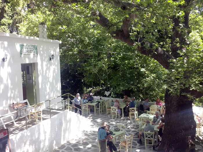
Part of Drosia restaurant’s very pleasant tree-shaded patio is seen in this photo from the Drosia Facebook page
Drosia’s outdoor terrace was as delightful as its delicious food — shaded by soaring trees, the patio is perched on the edge of a ravine through which streams cascade down the steep slopes. As we sat amidst thick vegetation, with the sound of water rushing in the creeks below us, it truly felt like we were in a lush island oasis — something we’ve never experienced on predominantly barren other islands in the Cyclades, like Mykonos, Ios or Santorini.
It was just a short — but sweet — visit to Stenies and Menites, and we realized we had merely scratched the surface in terms of the multitude of things to see and do in both areas. We hope we get the chance to go back and see more.
I shot this short video from the mountain road that took us to Stenies. It shows views of the mountainside settlement as well as nearby Gialia Bay. Click on the arrow to start the video.
Please click on the link below to turn to page 2 of this post, where you can read more about our day and view some of our photos of Stenies and Menites. You can see full-size versions of the pictures, along with dozens more, in my Stenies and Menites album on Flickr.
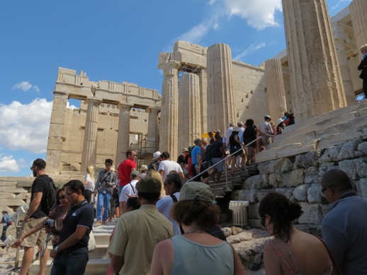
Tourists climb steps to the Propylaea, the monumental entrance to the Acropolis of Athens, on the morning of Sunday June 1
Wise move: A decision to extend operating hours for 33 of Greece’s top museums and archaeological site this summer is proving to have been a wise move, sparking a significant surge in the number of visitors to each of the attractions.
As I reported in a March 4 2014 post, the Greek Ministry of Culture recently implemented longer opening hours for nearly three dozen major museums and historic sites, including the Acropolis in Athens and the Archaeological Museum of Heraklion in Crete. From April 1 to October 31, each of the sites will be open from 8 a.m. to 8 p.m. every day of the week. (Many had previously been closed to the public on Mondays, and were not open for nearly as many hours on other days of the week.)
A May 30 news report on the Greek Travel Pages website says government data for the month of April has shown significant double- and triple-digit increases in visitor numbers and revenue at each of the venues offering extended hours.
Ticket sale increases ranged from 14% to 116%
The smallest increase was the 14.12% rise in ticket revenue reported for the Archaeological site of Sounion, while sales of combined entrance passes to a group of central Athens historic sites, including the Acropolis, also hit double digits, climbing by 17%.
The biggest increase in revenue was achieved at the Archaeological Site of Akrotiri, on Santorini, which reported a nearly 116% rise in sales compared to April 2013. The Archaeological Museum of Heraklion posted a 109% increase, while revenues rose slightly more than 100% at the White Tower in the city of Thessaloniki.
I was in Athens from May 30 to June 2 and saw substantially more tourists in the central area of the city than I recall seeing at the same time last year and in 2011 and 2010. In fact, in many parts of the city I heard more people speaking English, Italian and French than I heard speaking Greek. And during my June 1 visit to the Acropolis, visitors from China and Japan almost outnumbered tourists from other countries.
Greece had been anticipating a record 18.5 million visitors for 2014, but the Association of Greek Tourism Enterprises (SETE) last week predicted that the number will surpass 19 million.
Click here to read a June 3 Globe and Mail newspaper report on Greece’s tourism rebound…it includes comments by the Greek minister of tourism, Olga Kefalogianni.
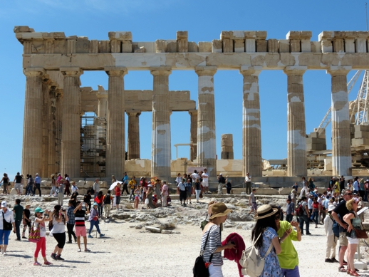
Throngs of tourists explore the area around the Parthenon on June 1.
History and archaeology buffs will enjoy visiting Kos island. In Kos Town, you don’t have to walk far to find monuments and historic ruins — they’re practically all over the place, right along residential and commercial streets as well as in the main tourist district in the center of town.