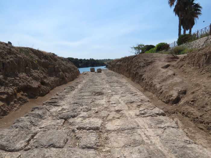
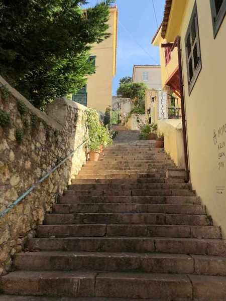
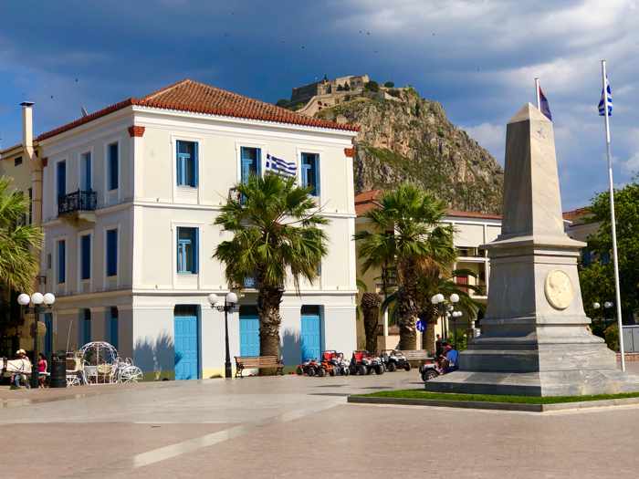
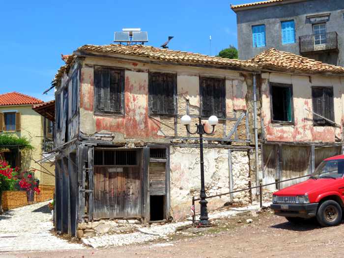
The Corinth Canal, an ancient boat slipway, a castle, an archaeological site and a museum were fascinating stops during our daytrip in the Corinth area of the Peloponnese
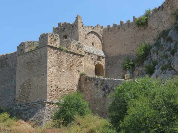
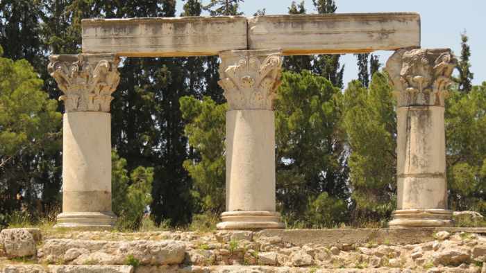
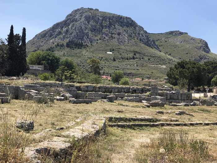
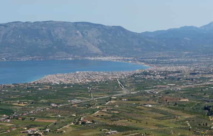
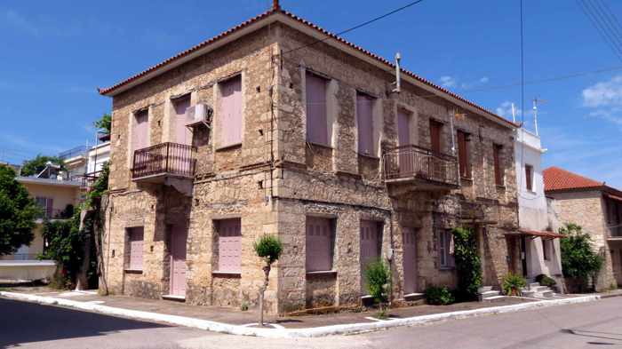
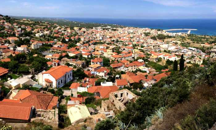
In less than half a day, we were able to visit such important historic sites as the Acrocorinth castle, top, the Ancient Corinth archaeological site and museum, center, and the Diolkos boat trackway at the western entrance to the Corinth Canal
Ideal for history buffs: During our short stay in Loutraki last May, we got to step thousands of years back in time with an easy daytrip visit to several of the premier historic attractions in the nearby Corinth area.
It was an ideal itinerary for history buffs as well as anyone who appreciates marvels of architecture and engineering.
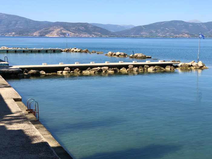
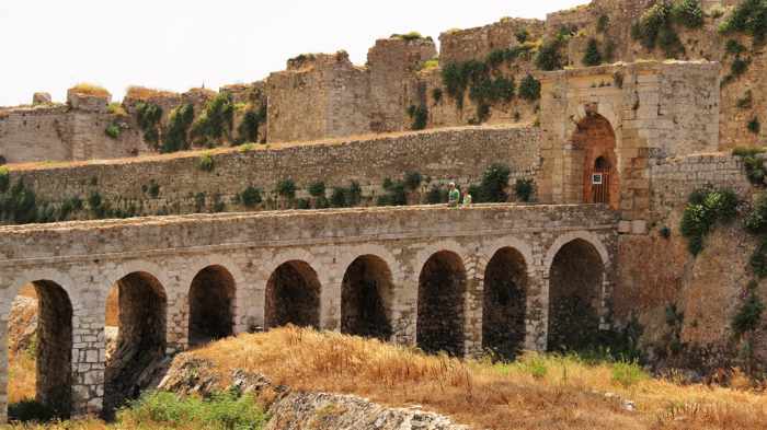
Our driving route took us across a submersible bridge at the northern mouth of the Corinth Canal, where we stopped to see the Diolkos, an ancient track that was used to transfer boats overland from the Gulf of Corinth to the Saronic Gulf, long before the canal was constructed.
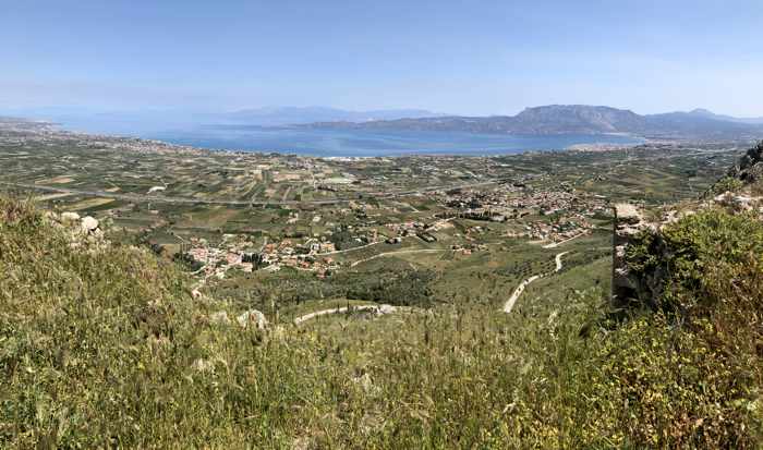
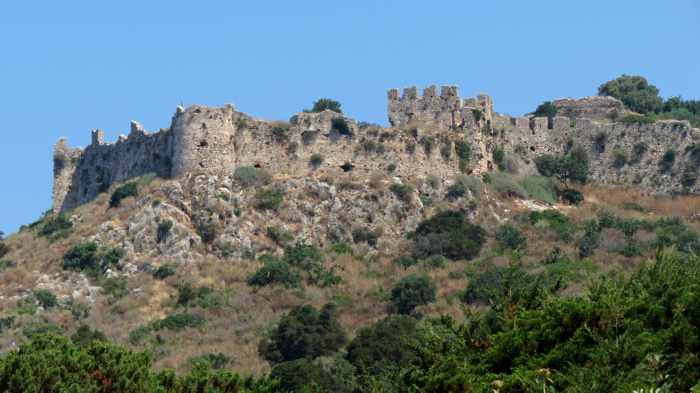
Next stop was the Acrocorinth Castle, where we wandered around the inside of the massive mountaintop fortress and enjoyed superlative views of the Corinth region.
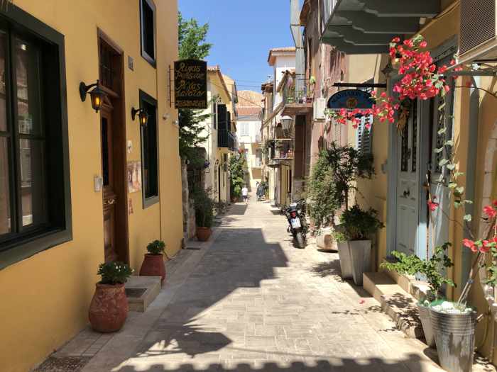
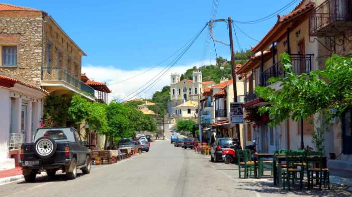
Lunch and a coffee break in the modern city of Corinth topped off our tour of amazing feats of engineering and impressive monuments and artefacts from centuries of Greek history.
I have written individual posts to show photos and information about the attractions at each of our stops. You can view them simply by continuing to scroll down the blog, or by clicking on any of the following links to access a specific article:
Uphill climbs, imposing walls, centuries of history and beautiful views: Photos from our visit to Acrocorinth, the largest castle in the Peloponnese
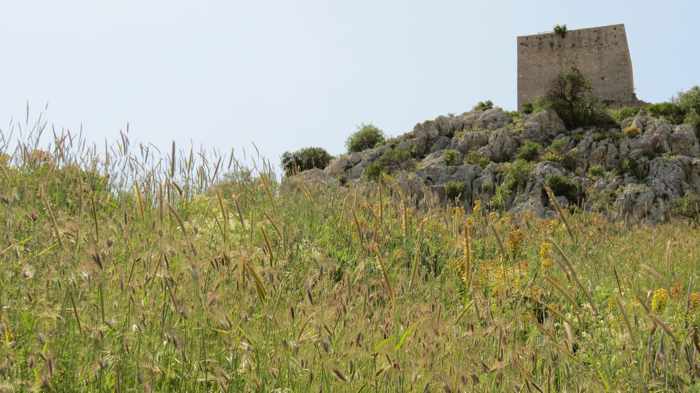
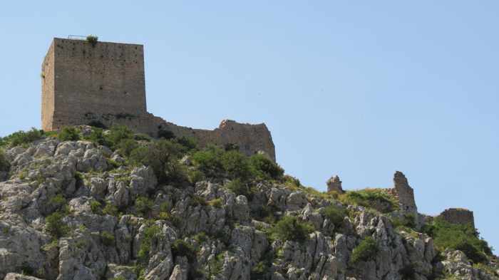
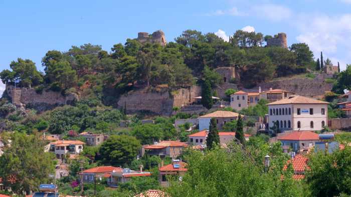
Acrocorinth Castle, top, occupies the peak of a 575-meter (1,880-foot) mountain that rises on the southwest side of the Ancient Corinth archaeological site, above. We explored the castle during a daytrip to historic sites in the Corinth area in May 2022.
Formidable fortress: I call it the Rock of Ages, because there’s an incredibly long history behind Acrocorinth, an impressive ages-old castle that sits astride a monolithic peak in the Corinth region of the Peloponnese.
Dating to pre-Christian times, the mountaintop site was the Acropolis of Ancient Corinth, a wealthy and influential city-state that was one of the biggest and most important cities in Greece, with a population topping 90,000 in 400 B.C. Over the centuries since, the stronghold has been ruled by the Romans, Byzantines, Franks, Knights of Saint John, Venetians and Ottomans.
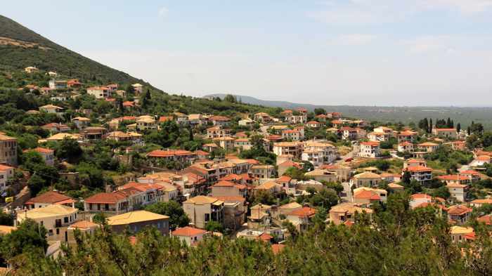
During our drive from the Corinth Canal to the castle, it was easy to see why Acrocorinth was such a prized property for empires of the past to acquire and control. The huge rock rises at a strategic position along crossroads of major trade, travel and military routes, and its high location provides commanding views of northeastern Peloponnese and two important waterways, the Gulf of Corinth and the Saronic Gulf.
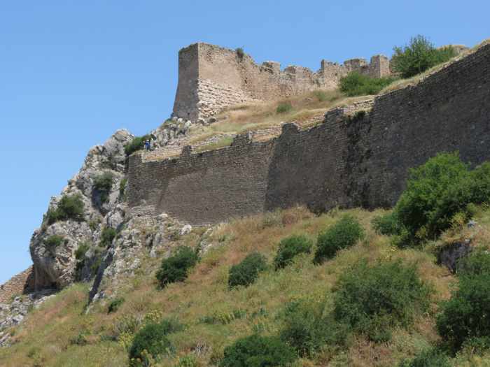
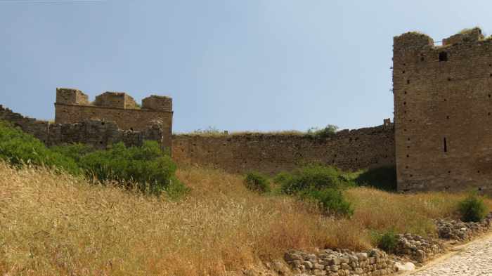
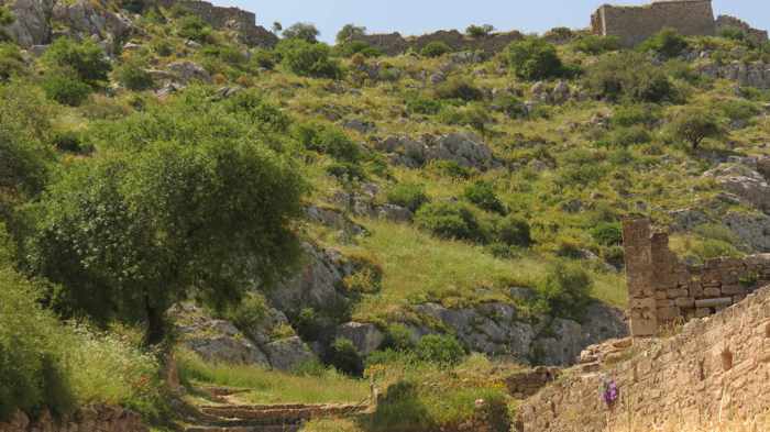
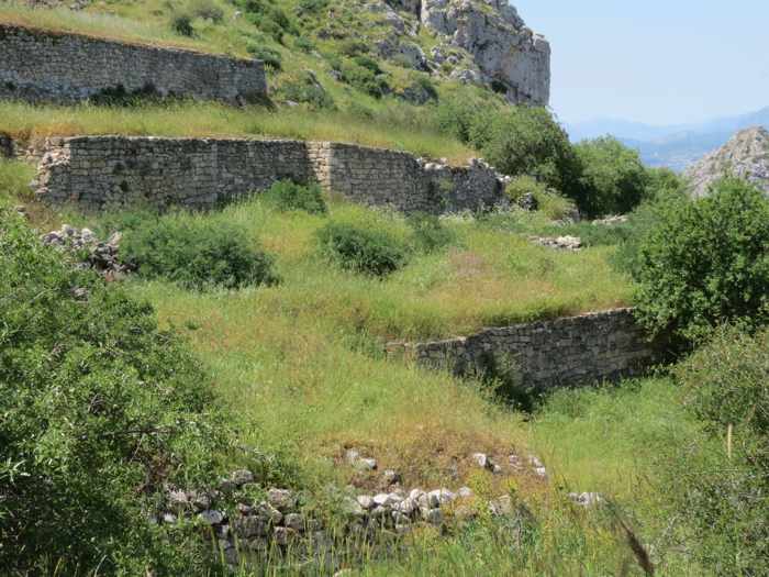
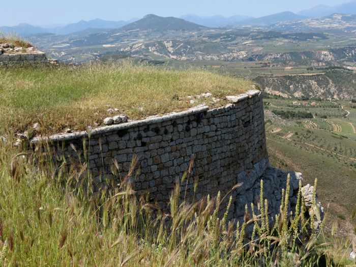
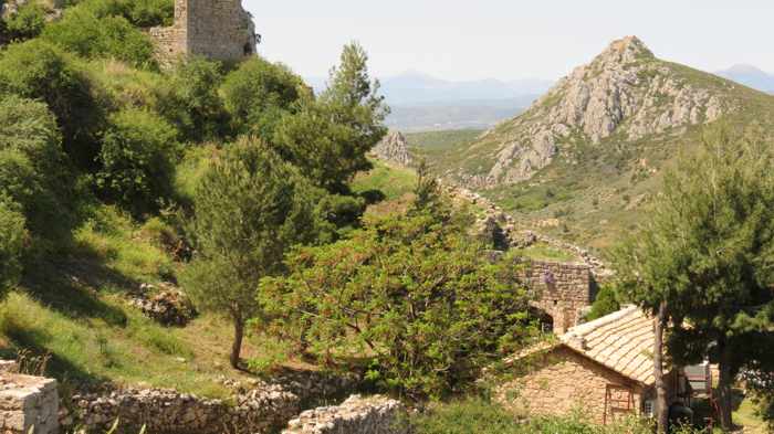
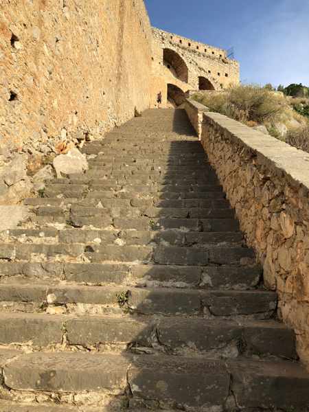
Acrocorinth is the largest castle in the Peloponnese, and its vast size immediately became apparent when we got out of our car in a parking area partway up the mountain and gazed up at the lower fortification walls. Imposing and tall, the stone structures extend almost 3,000 meters (nearly 10,000 feet) along the fortress perimeter, and enclose interior space of more than 240,000 square meters (59 acres). Even without knowing those startling statistics, we were struck by how absolutely enormous and intimidating the castle appeared from outside. It felt just as big once we got inside, too, and we didn’t even get to see all of the interior.
This short film by Travel and Drones was released in early December 2022. It presents dramatic and breathtaking aerial views of Acrocorinth and the nearby Corinth area of the Peloponnese
We managed to wander around Acrocorinth’s interior for nearly two hours before we felt too tuckered out to continue, thanks to the combination of our jet lag and all the walking (much of it on steps and slopes) under sunny skies and a temperature of 24 C (75 F). While we had been hoping to climb to the summit to check out the scenic vistas and look at the Aphrodite temple, a tower and the ancient fountain spring, we feared we would wilt along the way, and decided to head into the city of Corinth for lunch instead.
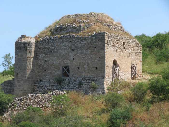
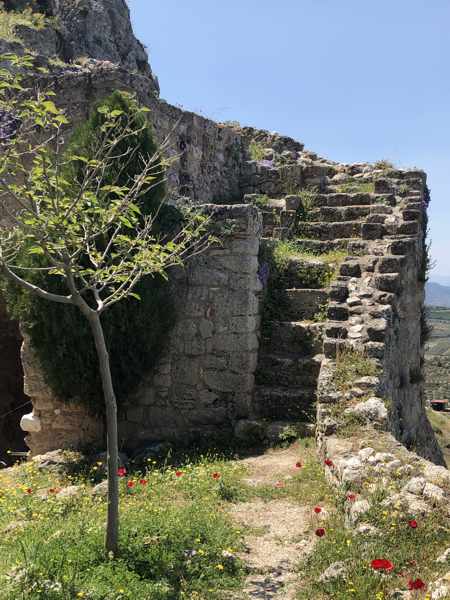
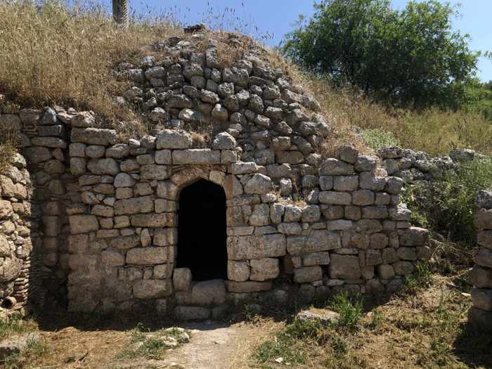
Even though we missed seeing a large part of the fortress’s upper grounds, we had a fascinating time. There are intriguing monuments and artefacts from antiquity and each era that the castle was ruled by a different empire — “the sanctuary of Aphrodite with an early Christian basilica on its ruins, the fountain of Ano Peirene, Byzantine cisterns, the Frankish tower, a Venetian church, mosques, Turkish houses and fountains,” a passage on the Ancient Corinth website points out.
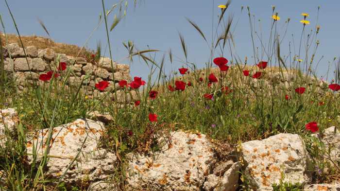
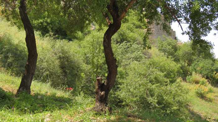
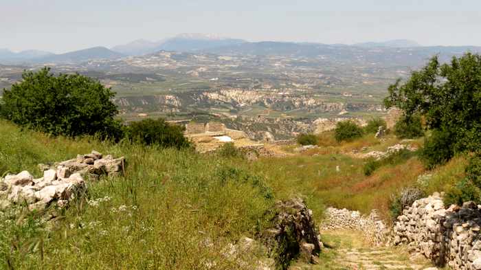
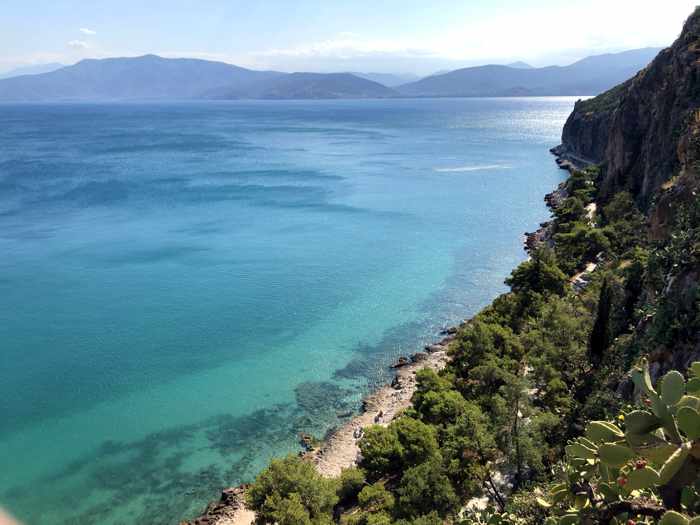
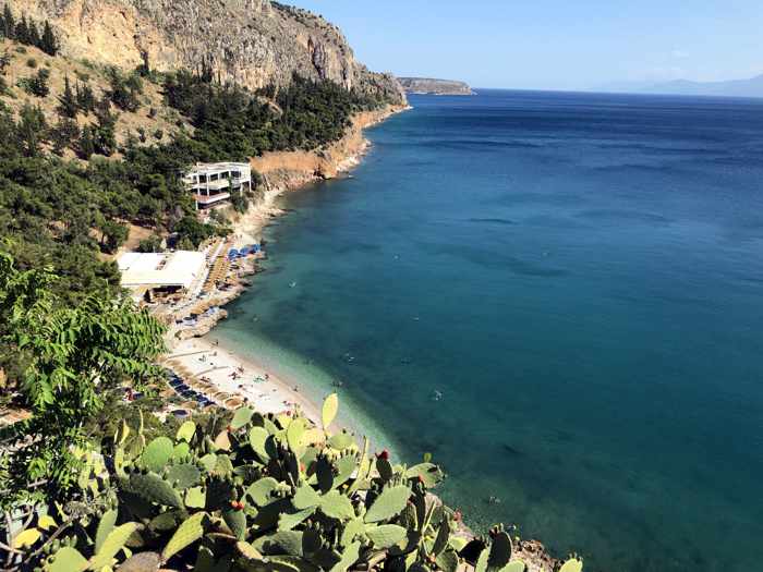
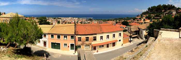
In May, it was exhilarating to stroll around since the grounds were vibrant and lovely with foliage, wildflowers, tall grasses and fields of wheat swaying in the breeze. There was so much lush and thick greenery, some of the ruins were obscured or partially hidden — nature appeared to be reclaiming the land. Views of the Corinth countryside and Gulf of Corinth were wonderful.
Scroll down to see photos from our visit. If you’re interested in learning more about the history of Acrocorinth, here are a few excellent website resources with articles, historic timelines, maps, photos and videos:
♦ the Acrocorinth entry on Picturesque-Peloponnese.com
♦ the OnRoadsUncharted.com blog post Guardian of the Peloponnese | A Guide to Acrocorinth
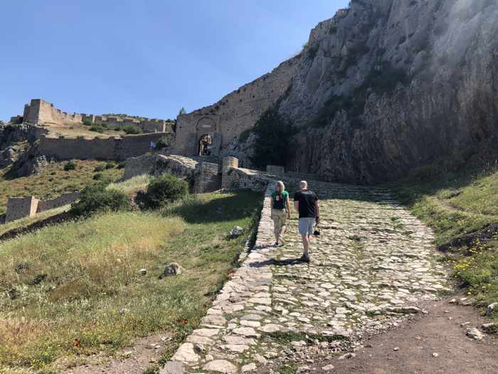
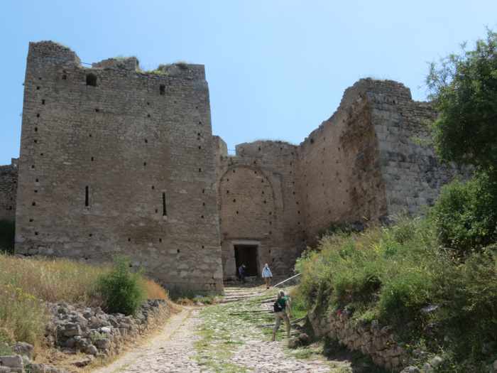
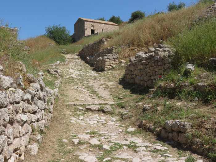
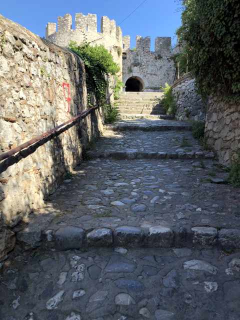
Arriving at Acrocorinth
Above, views of the cobblestone path that leads from the parking area to the castle’s first entrance gate (there are three gates in total). Although we were wearing sturdy hiking shoes, we found the stones quite slippery underfoot, and had to step slowly and cautiously while climbing uphill, taking even greater care walking back down. Inside the castle, there is a lot more uphill walking, on steps, slopes and uneven terrain. If you plan to visit, wear shoes with soles that grip well. Be aware that if you have balance or mobility issues, the climb into and back out of the castle could be treacherous. We saw many visitors wobbling and some stumbling on the paths. If you walk up or down the sides of the steps, you can hold onto walls or rocks to sturdy yourself on the cobblestones.
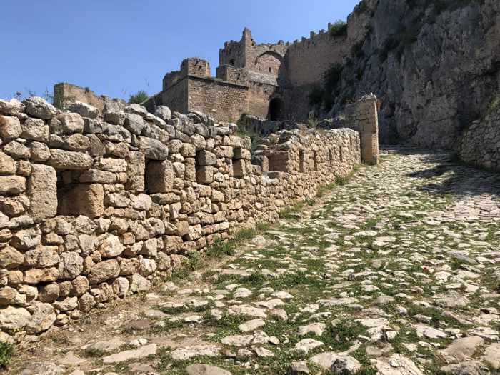
The cobblestone path through the second gate
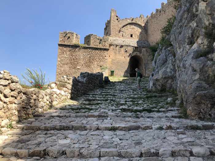
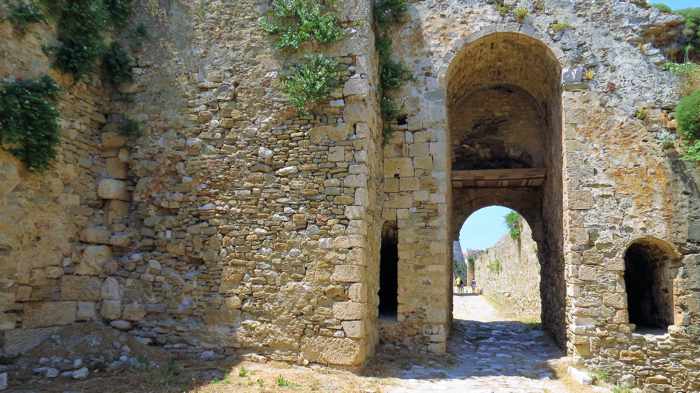
Approaching the mammoth third — and final — entrance gate
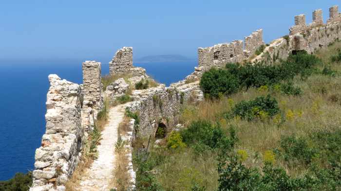
The massive fortification walls
Historians believe the first castle walls on Acrocorinth were built during the reign of the tyrant Periander, who ruled from 627 to 585 B.C. Over the centuries, some conquerors destroyed the fortifications, while others reconstructed them or added more. Any time I looked at the immense fortifications, I couldn’t help but wonder who piled all the heavy stones together, and how they were even able to perform the backbreaking work at the tops of cliffs and down the sides of steep slopes. It would have required Herculean effort to build, tear down or reconstruct those thick, tall ramparts and defensive walls.
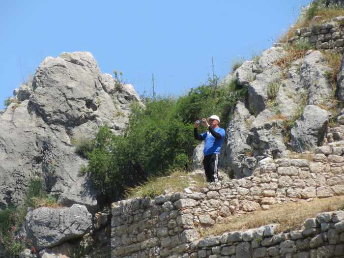
To get a sense of perspective of the enormous size of some of the castle walls, consider that the tourist taking a photo, above, is barely visible in the top photo.
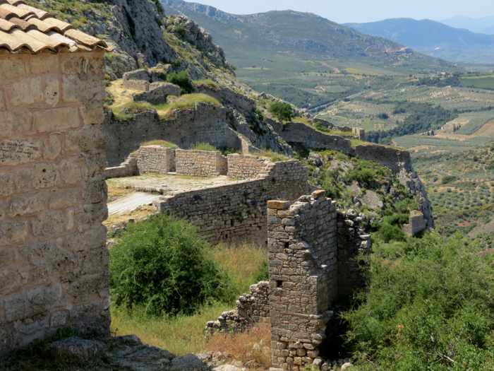
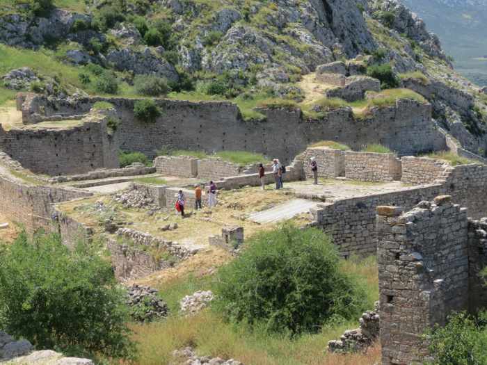
The interior grounds, monuments and ruins
Above, a tower and other structures on the upper-most points of the peak, where visitors can explore the remains of a sanctuary and temple originally dedicated to the goddess Aphrodite, and the spring fountain of Ano Peirene. Unfortunately, we didn’t make it to the top, so we don’t have any photos from that level of the fortress.
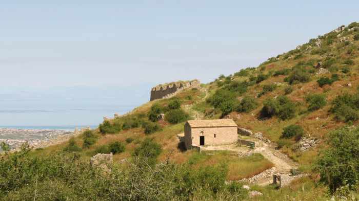
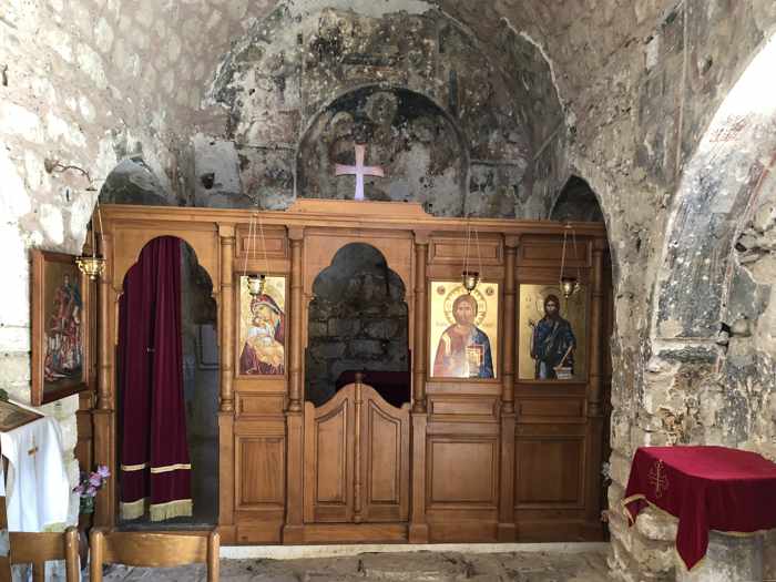
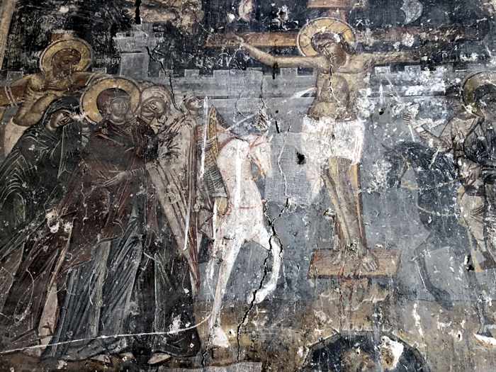
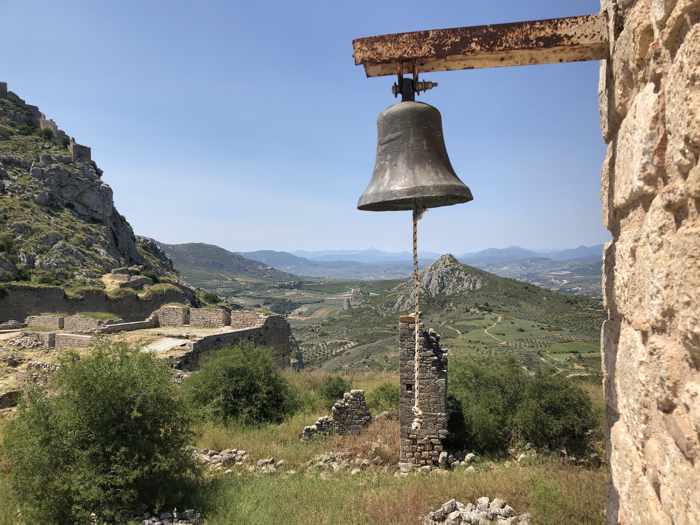
Agios Dimitrios church
Above, views of the Venetian-era Agios Dimitrios Church, its interior and one of its wall frescos, and the church bell
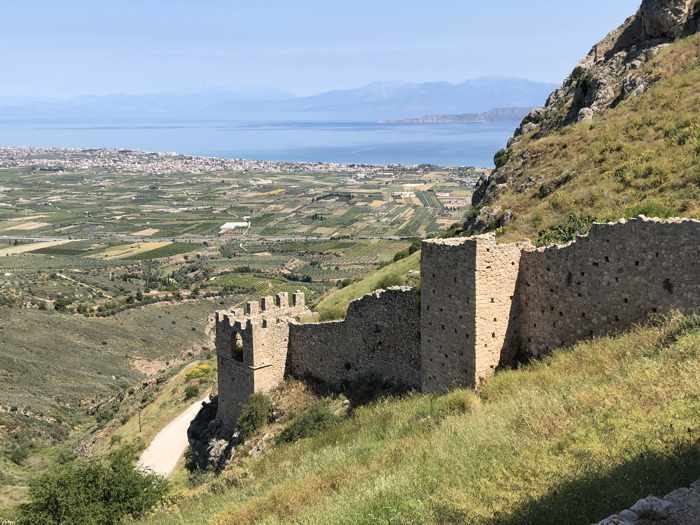
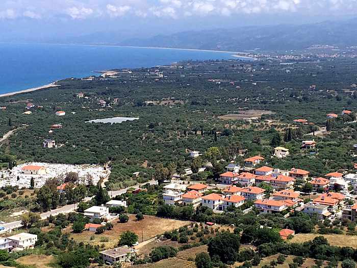
Views from Acrocorinth
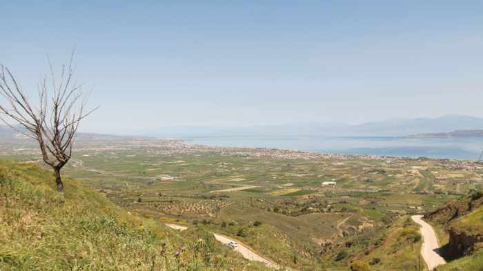
Above, some of the countryside views from the castle. The bottom photo shows the small cities of Corinth (foreground) and Loutraki (across the bay at the foot of the mountains), where we stayed for the first three days of our vacation.
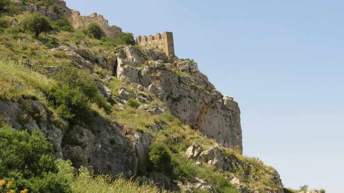
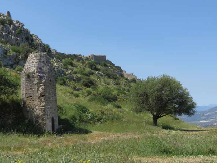
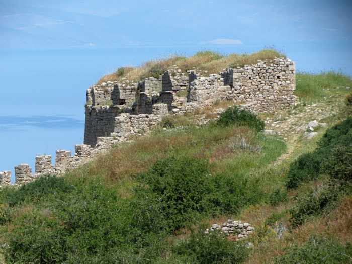
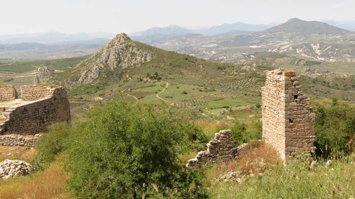
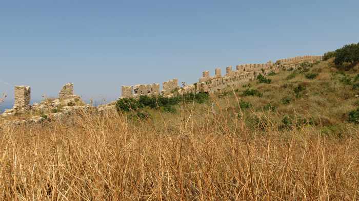
Acrocorinth views of Penteskoufi
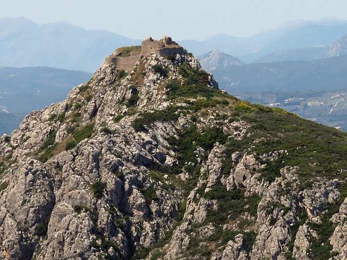
From Acrocorinth, visitors can see another nearby peak that is also crowned with a castle — Penteskoufi (also known as the Montesquieue Castle).
It was built by the Franks in 1205 as a strategic maneuver in their efforts to conquer Acrocorinth, which was held at the time by the Byzantine ruler, Leo Sgouras. It took several years for the would-be invaders to prevail. In 1208, as the Franks moved closer to capturing control of Acrocorinth by cutting off its access routes and supply chains, Sgouras committed suicide by riding his horse off a cliff. When supplies finally ran out a year later, Acrocorinth surrendered to the Franks.
Penteskoufi is a square fortress with a tower and six cannon ports. A trail to the castle apparently starts at the Acrocorinth parking area (though we didn’t see it), but the Kastrologos website says the route up the 476-meter peak is difficult and strenuous, and can be dangerous.
Danielle van Doorn filmed the video to her inspirational song Fly at Molyvos, Petra and other places on Lesvos island
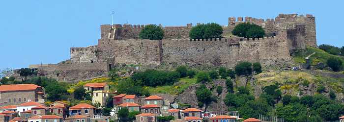
Scenic backup: Lesvos island plays a co-starring role in Fly, a pop music video released this month (April 2020) by talented young Dutch singer/songwriter Danielle van Doorn.
The beautiful town of Molyvos, the historic Molyvos Castle, Petra village and numerous inland and coastal locations on Lesvos provide scenic backdrops for the 3.5-minute video which van Doorn made as a posthumous birthday gift for Justin G. Valk, who produced the studio recording of the song prior to his death two years ago from Duchenne Muscular Dystrophy.
Known professionally as JRedsun, Valk also produced van Doorn’s 2017 single, Leave Me Alone.
We recognized several of the video filming locations since we stayed in Molyvos and visited Petra and other places during our first-ever trip to Lesvos in spring 2019, but I’m sure many more sites shown in the clip will be familiar to regular island visitors.
If you haven’t been to Lesvos before, the video will give you glimpses of some of the pretty town, coast and landscape scenery that await your discovery on this truly wonderful East Aegean isle.
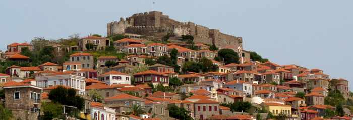
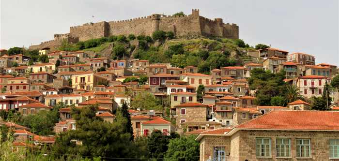
The Castle of Mithimna dominates views of Molyvos town from all directions.
Editor’s Note: This is the third instalment of my Moments in Molyvos series of photo reports from our 8-day visit to Molyvos (also known as Mithimna) in spring 2019. Part 1 featured photos of sights along the main commercial road and harbourside, while Part 2 contained pictures from walks in the town’s traditional market, and on the hillsides below the castle.
It’s the biggest, most important and most visible monument in Molyvos, so of course we had to pay a visit to the Castle of Mithimna during our first-ever Lesvos island holiday in late April 2019.
Nearly 650 years old, the castle occupies a hilltop location that has been historically significant for more than 2,500 years. According to a leaflet published by the Ephorate of Antiquities of Lesvos, an ancient acropolis stood on the site from around the 5th Century B.C. until sometime during the 6th Century A.D., when the Byzantines built a fortification in its place. The Venetians conquered the fort in 1128, but from 1204 to 1287 it was occupied by Baldwin II of Flandre. At the end of the 13th Century, the fortress came under Catalan control; however, much of the structure was destroyed when the Genoans seized the stronghold early in the 14th Century. In 1373, the Genovese Francisco 1 Gateluzo ordered the reconstruction of the castle, and the Genoans controlled it until the Ottomans took occupation of Lesvos in 1462. The Ottomans made repairs and additions to the structure in the 15th and 17th Centuries, but the form of the fortress — an irregular trapezoid shape with 10 towers and two strongholds — has remained essentially the same to this day.
Further historical background information is available on the Molyvos/Mithimna Castle page of Odysseus, the official website of the Greek Ministry of Culture and Sport. The link contains two pages of historical and descriptive information, and while it’s available in Greek only, you can use an online translation program to read it in English or other languages. Additional information, along with maps and a video, on the Castle of Mithimna page of the Kastrologos Castles of Greece website.
To reach the castle from the main road in Molyvos, we had the choice of walking or driving to the top of the rocky hill. We preferred to hoof it, which meant huffing and puffing our way up dozens of flights of steps on the steep hillsides below the castle. It sounds like an arduous trek, but it’s actually a great opportunity to explore some of the scenic residential neighbourhoods of Molyvos en route. (You can see what these areas look like in Part 2 of this series).
Admission to the castle cost only €2 per adult in April 2019.
This video by Yiorgaks takes you on a scenic flight over Molyvos, providing excellent views of the castle and upper town areas of Molyvos, and beyond
Please click on the link below to turn to page 2, where I have posted our photos of the castle (inside and out) and its views.
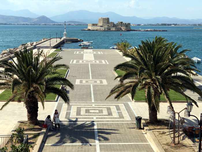
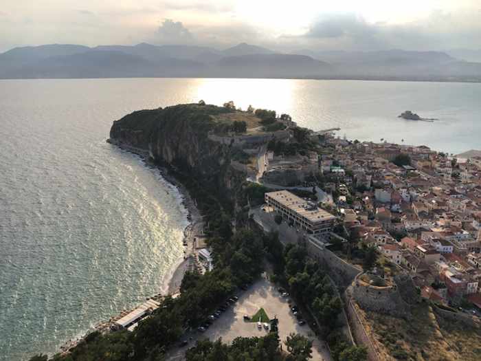
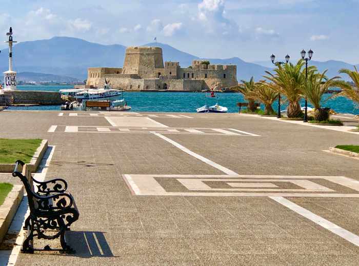
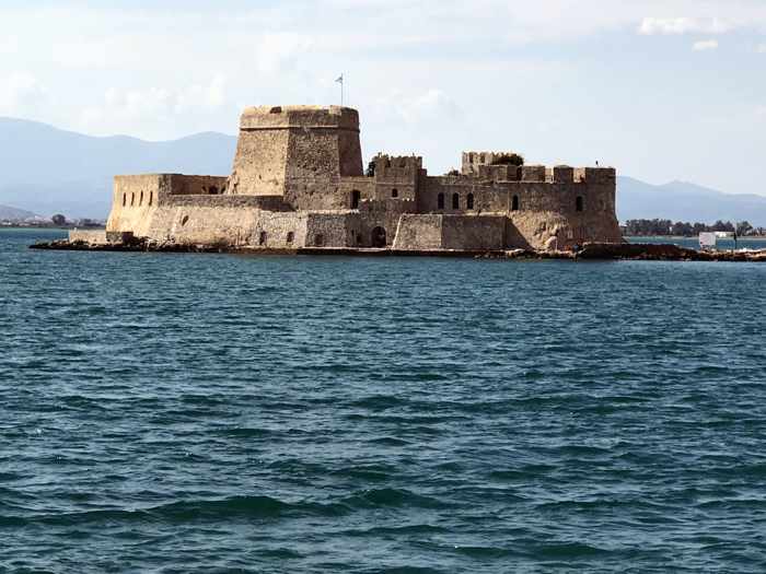
Nafplio waterfront view to the Bourtzi sea fortress
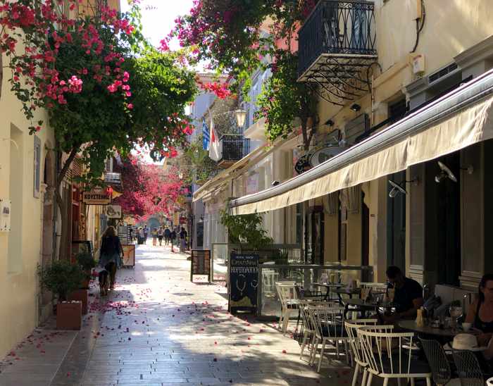
Back again: Exactly two years ago, we travelled to Nafplio for the first time and spent a full week exploring areas in and around the town. We liked it so much we decided it was high time to come back for a return visit. And here we are, enjoying Nafplio just as much as we did the first time. It truly is one of our favourite places in all of Greece.
Below are some sights and scenes from our first couple of days in the historic Old Town district of the picturesque seaside town. I will publish more images in separate posts.
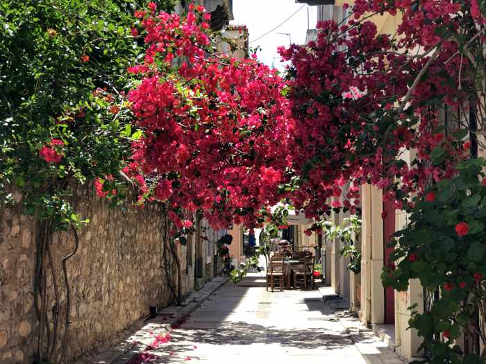
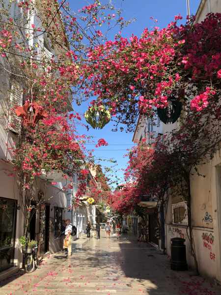
A canopy of bougainvillea in a lane in the Old Town district of Nafplio
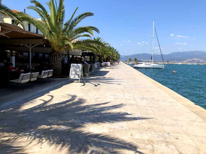
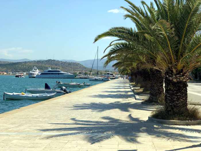
Cafes and palm trees along the Nafplio waterfront promenade
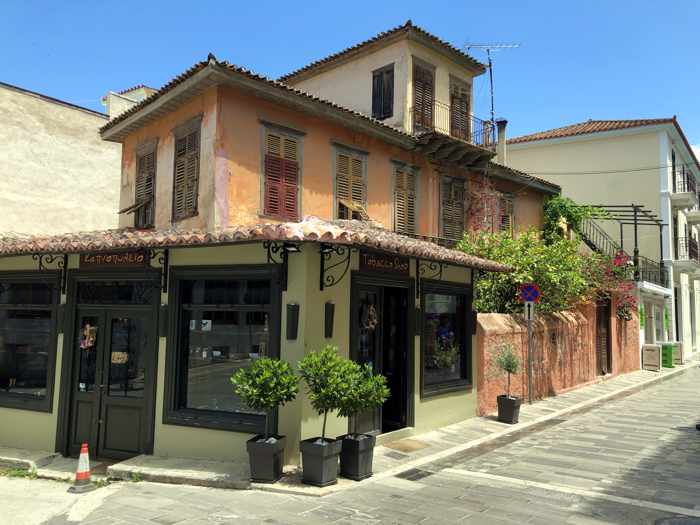
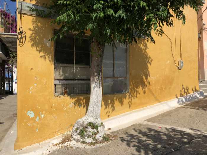
A rustic building on a street corner in the Nafplio Old Town
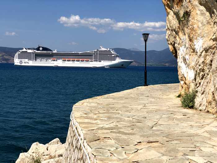
The MSC Poesia cruise ship, viewed from the Arvanitia coastal promenade. Daytrippers from the cruise gave the Old Town a lively buzz, but didn’t overcrowd the streets or make the town feel uncomfortably busy in any way.
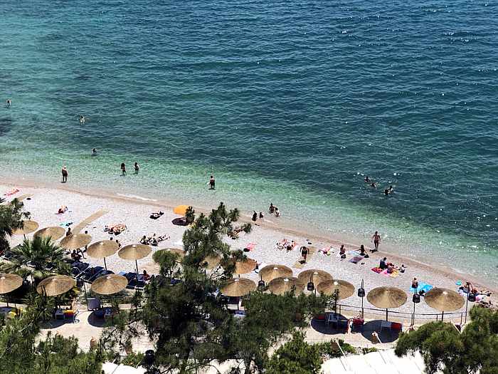
The Banieres swimming area on the Nafplio waterfront is a popular place for locals to sunbathe or take a dip in the sea
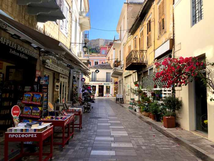
One of the colourful pedestrian streets in the commercial area of the Old Town
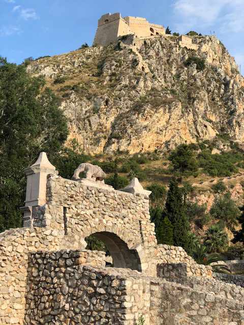
The Palamidi Castle (top) and the historic Land Gate, the original main entrance to the Nafplio Old Town
An evening view of the Old Town, from a point roughly two-thirds of the way up the nearly 1,000 steps to the Palamidi Castle
A steep flight of steps leading to the mountaintop Palamidi Castle. I counted 80 stairs on this particular stretch of the climb to the top.
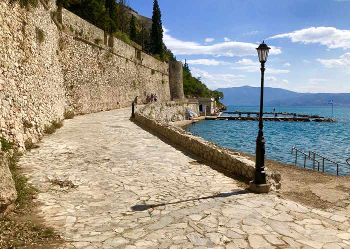
It’s much easier to reach the Acronauplia fortress, one of the three castles at Nafplio, since considerably less stair climbing is involved. This is the stepped path leading from the upper Old Town to one of the Acronauplia entrance portals.
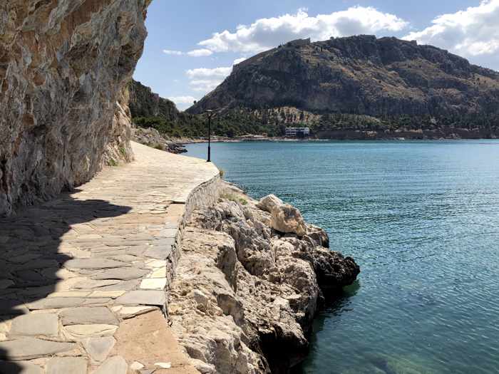
Coast and sea views from the Acronauplia fortress
Acronauplia fortress views of the sea, coast and Arvanitia beach
Part of Arvanitia, a stone and pebble beach that’s popular with locals and tourists alike since it’s only a short walking distance from the Old Town
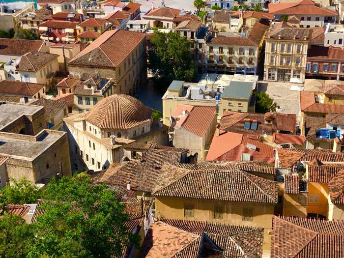
From a vantage point in the Acronauplia fortress, a view of Syndagma Square (upper right) and the first Greek Parliament building — the building with the domed roof at center left. Nafplio was the capital of Greece from 1823 until 1834, when the Parliament was relocated to Athens.
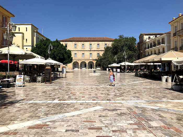
A quiet morning moment at Syndagma Square, which is lined with cafes, shops, restaurants and the archaeological museum (top)
A street in the pedestrianized commercial area of the Old Town
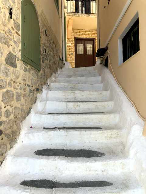
A long flight of steps on a hillside lane in the Old Town
Part of Kapodistriou Street, where our accommodations were located
A lane near the top of the Old Town’s hillside area
A peek at the exterior of the Catholic church in the Old Town
Philellinon Square and the memorial to the French soldiers who fought for Greece in the country’s war of independence
A restaurant patio along one of the main pedestrian streets in the commercial heart of the Old Town
Steps in a narrow hillside lane in the Old Town
Nafplio waterfront view to the Bourtzi sea fortress
People can take a small excursion boat to visit the castle. The trips are offered daily and cost €4.50 per person; they include a 20 minute stop for a walkabout on the castle islet (the interior of the fortress is closed for maintenance construction) and a short ride along the waterfront so passengers can enjoy sea views of the Old Town.
The Arvanitia coastal promenade and the Banieres swimming area of Nafplio
A tree-shaded section of the Arvanitia coastal promenade that leads from the Nafplio Old Town to Arvanitia beach
View from the promenade toward Arvanitia beach and the Palamidi Castle, partially visible on the mountain peak at upper right
The waterfront promenade is lined with palm trees on one side, and boats on the other
A rustic corner building on a hilltop in the Old Town
Houses on the hillside below the ruins of the Castle of Kyparissia, which was built during the 13th Century
Impressive introduction: On the fourth day of our May 2017 road trip through the western Peloponnese we discovered another charming town to which we will have to pay a longer return visit sometime: Kyparissia.
We had scheduled Kyparissia for just a sightseeing stop during our drive from Marathopoli to Katakolo, yet within minutes of stepping out of the car we were already wishing we could stay longer than just the afternoon.
That strong first impression came from the quick realization that Kyparissia has all the key features and characteristics we find particularly appealing in a small Greek town: beautiful scenery and views; a castle and lots of old buildings that convey a strong sense of history; plenty of intriguing lanes and streets to wander and explore; picturesque buildings and interesting architecture; inviting places to have coffee, dine, and do a bit of browsing or shopping; and a comfortable “I feel at home here” ambiance.
However, with fewer than five free hours before we would have to hit the road again, we knew we were only going to scrape the surface of all that Kyparissia and its surrounding area have to offer. Still, we enjoyed everything we did manage to see and do in our limited time, and we were glad we had included the town as one of the stops on our journey. We would consider Kyparissia to be a “must see” destination for anyone undertaking a driving tour like the one we did through the western Peloponnese, and we think it definitely deserves more than a quick look around.
When we arrived at El. Venizelou Street in Kyparissia in late morning, clouds above the nearby mountains suggested we might get rained on. But most of the clouds cleared away, leaving us with bright sunshine all afternoon.
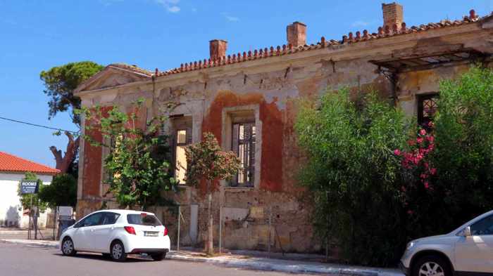
We’re drawn to old buildings, whether derelict or restored, and we found the facade of the former National Bank building — now a historic landmark — right across the road from where we parked the car upon arriving in Kyparissia
We found this once-elegant edifice near the National Bank, and spotted many more charming old buildings throughout the town
Upon arrival in Kyparissia, we parked briefly on El. Venizelou Street in the lower town so we could have a look around and check out a few of the shops. The road was lined with a mix of commercial and residential buildings from different architectural design eras, including elegant old buildings, some of which — like the former National Bank — were in derelict condition, and others that were either in excellent shape or appeared to have been painstakingly restored. They gave us a sneak peak of the wide variety of building design styles and construction periods we would soon encounter in Kyparissia’s Ano Poli, the historic hilltop Old Town, where we had planned to spend most of our time.
Our next stop was Eleni Chameri Street, the main road in the Old Town, where we found on-street parking close to the Memorial of the Fallen. The war monument is situated in a small square with amazing views that include the Castle of Kyparissia off to the right, and the entire town below, extending all the way down the hill to the sea.
A view along the Eleni Chameri Street, the main road of the Ano Poli / Old Town district of Kyparissia
From the square where the Memorial of the Fallen monument is located, visitors can see the Castle of Kyparissia (upper right) and the town below
From the memorial we walked to the Castle of Kyparissia, located at the opposite end of Eleni Chameri Street. We strode through the open gate (there is no ticket booth at the entrance) and climbed steps and trails up the hillside to see what remains of the ancient fortress. Apart from the external fortification walls, only a few stone buildings still stand on the site — but none are open to the public. It doesn’t take long to wander around and explore the grounds, but the castle is worth a stop, especially for its wonderful views of Kyparissia and the surrounding area.
Kyparissia Castle has excellent views of the upper town …
… the lower town and the sea to the southwest …
… and the lowlands, mountains and Messenian coast stretching to the north as far as the eye can see
After our castle hike we returned to Eleni Chameri Street and made a beeline for Algo-rithmos Cafe Bar, where we sat in the shade at one of the tables out front to have coffees and rest our legs. Refreshed from our coffee break, we all set out on our separate ways to explore the Old Town and vicinity. There was little traffic and only a few people out and about, so the neighbourhood was exceptionally quiet and peaceful. It was nice not having to jump out of the way of passing cars and trucks, or jostle past other pedestrians, while observing the scenery and taking photographs. The place is probably bustling during July and August, so we were glad we got to enjoy the town’s scenic streets and lanes without hordes of tourists teeming about.
The Old Town’s streets and lanes are lined with a fascinating mix of meticulously maintained houses …
… a few beautiful churches …
… and numerous derelict or dilapidated buildings bursting with charm, character and — in many cases — tremendous renovation potential
We regrouped back at Algo-rithmos for another coffee break a couple of hours later, then did some souvenir shopping across the street at Messinia Gi, a store which carries an extensive selection of food, beverage, fashion and souvenir products made locally in Messenia. After more walking around, we all agreed it was time to call it quits on sightseeing, and find a nice spot for lunch. We chose Palia Agora, which is located just a few doors down the street from Messinia Gi, where we sat outdoors and enjoyed a variety of delicious mezes. I will tell you more about Messinia Gi and Palia Agora in a separate post.
The fabulous meal brought our brief Kyparissia visit to an end on a high note. We reluctantly piled back in the car for the drive to Katakolo, where we would spend the night before heading to the port at Kyllini to catch a ferry to Kefalonia. We’ll go back to see more of Kyparissia another time. We’ve got to — it’s exactly the kind of place where we enjoying spending vacation time.
Please click on the link below to turn to page 2, where I have posted more photos of the Old Town and castle, as well as a video of the castle and its views.
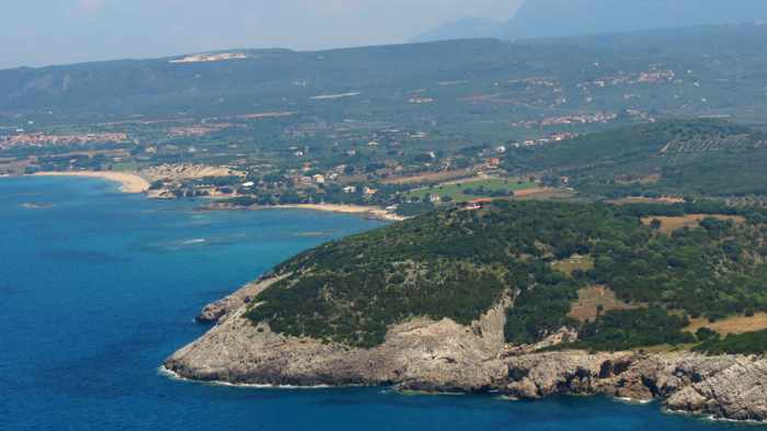
Walls on the southern side of Palaiokastro, the Old Castle of Navarino, which was built in 1278 near the town of Pylos in the Peloponnese
Though parts of the castle walls have collapsed, you can walk atop some of the remaining sections, such as this one high above the Ionian Sea
Walking inside the walls can be difficult — even perilous in places — if you stray off the main trail or try to take a shortcut from the west wall to the east, as we did. The castle’s south yard is overgrown with shrubs and prickly bushes, and the ground is covered with loose rocks and stones that wobble and roll underfoot.
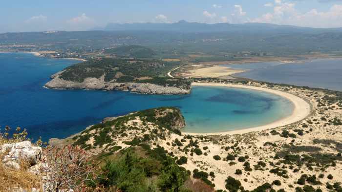
The big payoff for those people who make it all the way up to the northeastern corner of the castle: The incredible views of the Ionian Sea, Navarino Bay and the beautiful Messenian coast …
… and, most impressive of all, the stunning Voidokilia beach
Scenic trek: Built 740 years ago, the Palaiokastro / Old Castle of Navarino is certainly showing its age.
Its hilltop exposure to the elements, plus hundreds of years of neglect, have taken a severe toll. The outer walls are crumbling — some sections have collapsed, while others appear ready to tumble anytime — and only ruins remain of the buildings that once stood inside. Those structures have been reduced to rubble; the former walls and foundations are now boulders, stones and rocks scattered across the ground. The two castle yards are almost entirely overgrown with shrubs, prickly plants, tall grasses and trees that obscure most of the fortress’s interior. It’s possible to walk on some of the outer walls, and dirt paths wind through parts of the grounds, but it can be dangerous to step off the main trails — the rocks underfoot tend to shift and wobble as you walk over them, so there’s a constant risk of slipping and falling or twisting an ankle.
Because of the ancient castle’s derelict condition, plus the ever-present possibility of loose stonework falling from its weathered walls, the Palaiokastro is supposed to be out of bounds to visitors. There’s no fencing to keep anyone out, and no security guards to stop people from entering — just a solitary sign warning that “The Castle of Navarino is closed due to serious danger.” But that doesn’t deter thousands of tourists from visiting the site every year.
For most, it’s the breathtaking “must see” views that attract them — especially the castle’s unrivalled vantage points for photographing the incomparable and immensely Instagrammable Voidokilia beach.
That’s the main reason why I climbed up to Palaiokastro during our trip through the Peloponnese in May 2017 — I wanted to experience, in-person, the outstanding Voidokilia beach views that had fascinated me in many travel photographs and videos I had seen over the years.
[adToAppearHere]
To be honest, I didn’t know the castle was closed, and I also didn’t see the “danger” sign at the bottom of the access path. (My hiking companions did, but they never mentioned it.) I had read about Palaiokastro on a few travel websites, and knew that it consists mainly of defensive walls enclosing crumbled ruins, but none of the articles had said anything about the castle being closed or possibly dangerous to visit. Some sites even described it as a not-to-be-missed historical attraction. I figured it would take some effort to reach, since it’s situated atop a craggy hill a few hundred meters high. But once up top, I expected that it would be relatively easy to walk around, like the marvellous Methoni Castle which we had visited just the day before (see my post: A walkabout in Messenia’s 800-year-old Methoni Castle for an account of that.) So when we found the castle access path at the northwest end of Divari beach, I was eager to head up for a look around.
To continue reading and to see more photos of Palaiokastro, please click on the link under the video below to turn to page 2.
This video by AllMessinia takes you on a short flight above Palaiokastro, while subtitles provide historical information about the monument
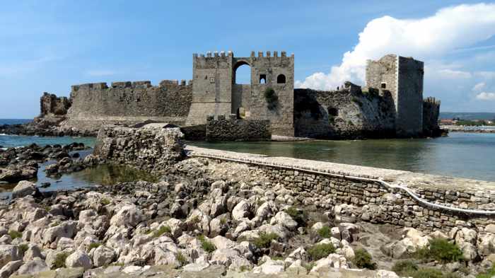
The southern fortification walls of Methoni Castle, viewed from the Venetian-era Bourtzi fortress (below)
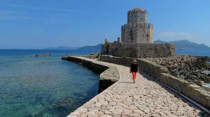
The Venetians built the octagonal-shaped Bourtzi fortress on a rocky islet connected to the castle by a stone-paved causeway
Methoni meanderings: Day 2 of our western Peloponnese road trip turned out to be rather “monumental” for us, figuratively speaking, as our travels took us to churches, archaeological sites and castles — some more than 800 years old — plus a place where two major Greek maritime conflicts occurred.
Our drive to and through hundreds of years of history took us first to the Byzantine Church of Samarina, which dates from the 12th Century, followed by a walk around the ruins of the Castle of Androusa, which was built in the 13th Century.
Next stop was the town of Pylos on Navarino Bay, where two of the most significant naval combats in Greek history took place: the Battle of Pylos which was fought in July of 425 B.C. during the Peloponnesian War, and the October 20 1827 Battle of Navarino, the most pivotal and decisive event of the Greek War of Independence from Turkey. Besides observing the bay from a variety of vantage points in and around Pylos, we managed to see some of the exterior fortification walls of the impressive Neocastro (Castle of Pylos), which was built in 1573. Unfortunately, we didn’t have time to go inside to tour the castle interior and see its remarkable hexagonal citadel.
Our final sightseeing stop was the town of Methoni, where we paid an afternoon visit to the majestic Methoni Castle.
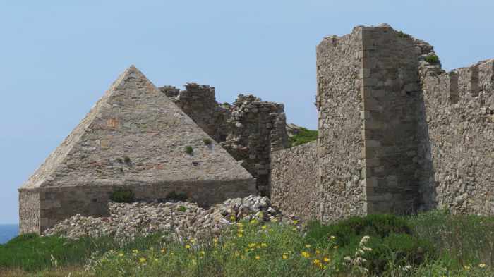
Constructed in 1209 by the Venetians, Methoni Castle occupies a sprawling site encompassing nearly 38 hectares. The castle is so big we couldn’t explore every sector during the two hours we walked around, but we did cover a lot of ground, and managed to see the highlight attractions, including the Bourtzi sea fortress, the Ottoman baths, and the Church of the Metamorphosis Sotiros. (We might have spent more time meandering through the ruins had it not been so sunny and hot.)
The stone bridge and entrance to Methoni Castle
This pyramid-roofed building was apparently used to store munitions. The inner castle wall beside it is crumbling in places, but visitors can still walk on the top to get views of the entire castle site.
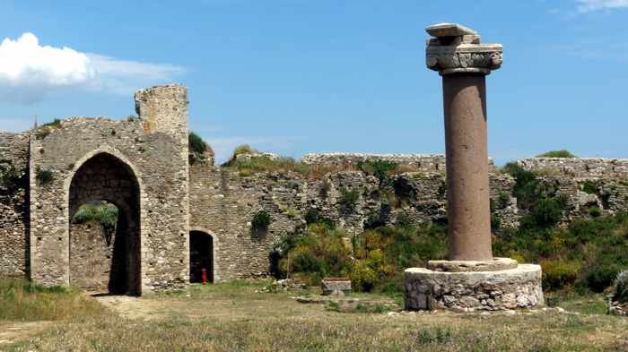
A curiosity inside the castle is a tall, red granite column topped with a Byzantine-style capital. Often called “Morosoni’s Stele,” the column is believed to have been topped with either a sculpture of the winged lion of Venice, or a bust of the Venetian Doge Francesco Morosini.
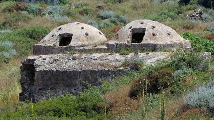
The round, domed roofs of the former Turkish baths (hamam)
A tall, arched passageway inside the fortification walls
One of the patterned floors inside the Church of the Metamorphosis Sotiros
My favourite castle features were the elegant stone entrance bridge (built by the French in 1829 to replace a wooden drawbridge), the Bourtzi fortress, the interior of Metamorphosis church, and the breathtaking 360-degree views from atop one of the main inner walls. I also was fascinated by the variety of shapes and angles that architects had chosen when designing the castle’s imposing fortification walls and the buildings they protected. These included rounded and pointed archways, square and rectangular houses and public buildings, an arsenal with a pyramid-shaped roof, the octagonal Bourtzi fortress, sloped and vertical defensive walls, and the round, spaceship-like domed roofs of the hamam (Turkish baths) built by Ottoman occupiers.
Admission cost only €2 per person, by the way — a bargain, considering the size of the castle.
Below is a brand-new aerial video of Methoni Castle that was published, coincidentally enough, right while I was putting this post together. On page 2 you can view some of the photos we shot while meandering through the ruins. If you’d like to read more about the history of Methoni Castle, click here to read a detailed description from the Kastrologos Castles of Greece website.
The grandeur and vast size of Methoni Castle are captured in this aerial video published February 28 2018 by George Magoulis