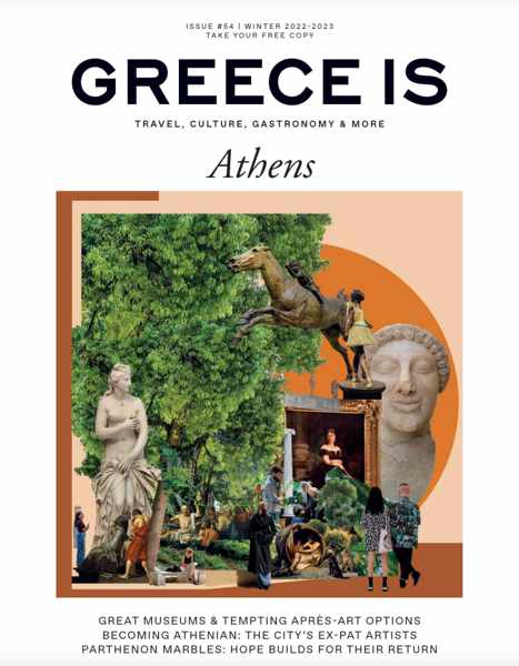
A special edition of Greece Is Magazine profiles events and activities in Athens during winter 2022-2023
The cover of the Athens edition of Greece Is magazine for Winter 2022-2023
Winter wonders: The latest Athens issue of Greece Is magazine sure would have come in handy during a recent Christmas party conversation about winter travel plans. After friends and acquaintances described their upcoming trips to Florida, Australia, Mexico and the Caribbean, everyone looked perplexed when I said that I wished I could visit Athens. “But isn’t everything there closed down?” one of my acquaintances asked. Similar questions by others in the group suggested they, too, think Greece is only a summer beach destination.
Like many people, they just don’t realize that, even during the cooler months of off-season, the capital of Greece is always brimming with engaging arts and culture events, and fun food, drink and entertainment activities.
Why wouldn’t it be? It’s a major international city, after all, and its 3 million residents don’t go into hibernation until Greek Easter. They like to get out and about to experience their city’s cultural attractions and events, and there are plenty of those to enjoy throughout the winter months — as the Athens Winter 2022-2023 special edition of Greece Is magazine points out.
Released in early December, the 148-page issue includes:
♦ A spotlight on things to see and do in Athens — both indoors and out — on mild winter days
♦ Photos and information about visiting the Makrigianni site — the ancient streets beneath the Acropolis Museum
♦ “Art & the City,” a look at local hangouts for food, drinks and shopping in the neighbourhoods near the city’s major museums and art galleries
♦ “At the museum with the kids,” an article that highlights “tailored programs and tours” geared specifically for children — a must-read for families travelling to Athens
♦ In “Dining Out: Then & Now,” writer Christos Chomenidis “connects the past with the present” as he describes visits to five noteworthy restaurants that each have “their own story to tell.”
♦ “Finding philosophy among the ruins,” a piece that traces the “ancient Greek philosophers’ favourite haunts in and around the Athenian Agora”
♦ “Dreaming of the blue skies of Attica,” an essay that considers “why the return of the Parthenon Sculptures is a democratic imperative,” and much more.
If you’re planning a winter trip to Athens, or simply wondering if it’s worthwhile to visit at this time of year, have a look through the magazine. You’ll find lots of helpful information and great suggestions for places to visit and things to do — more than enough to keep you entertained and enthralled.
Print copies of the Athens issue are available from the Greece Is e-shop, while the online edition can be viewed, read, shared and even downloaded from this link on Issuu.com.
Video views of archaeological sites and superb scenery at the top historic places of Ancient Corinth
The 6-minute film Ancient Corinthia from high above captures breathtaking aerial views of the major historic locations of Ancient Corinth
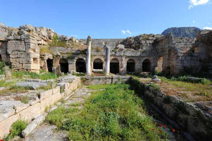
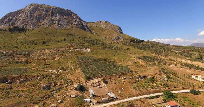
For history buffs and landscape lovers: The Corinth region of Greece is home to a plethora of important sites that will impress visitors who are fascinated with ancient Greek history. And since they’re situated in beautiful outdoor locations, these places should appeal even to people who aren’t history buffs, but who enjoy seeing and spending time in picturesque landscapes, countrysides and coastal areas.
That’s why we think both types of traveller will enjoy watching the video we have shared above. Produced by the Archaeological Museum of Ancient Corinth, it captures amazing visual perspectives of Ancient Corinth’s signature ruins and monuments amidst their scenic surroundings.
Historic sites shown in the video include, in order of appearance:
♦ Krommyon at Ayioi Theodori
♦ Sanctuary of Hera at Perochora
♦ Ithsmus / Corinth Canal
♦ Diolkos at Poseidonia
♦ Sanctuary of Poseidon at Ithsmia
♦ the submerged ancient port at Kenchreai
♦ Solygeia at Galataki
♦ Tenea at Klenia and Chiliomodi
♦ Poros Limestone Quarries at Examilia
♦ the harbour at Lechaion
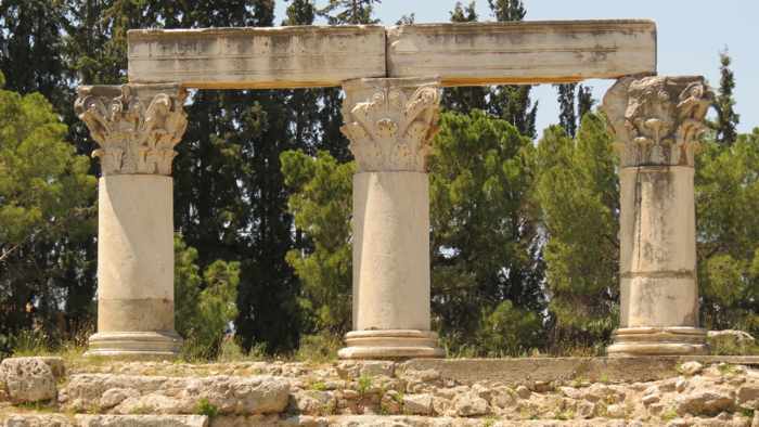
♦ Ancient Corinth
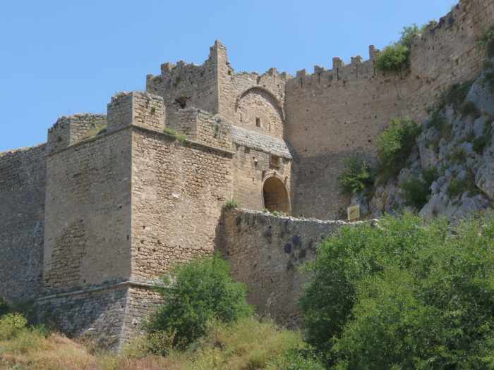
♦ Acrocorinth
♦ Sanctuary of Demeter and Koris
♦ Sanctuary of Asklepios
♦ the Theater at Ancient Corinth
♦ Temple of Apollo
The Peirine Fountain, seen in a photo from the website for the Ancient Corinth Archaeological Museum
We got to see several of the locations — Sanctuary of Hera, Corinth Canal, Diolkos, Acrocorinth, as well as the Temple of Apollo and many other monuments at the Ancient Corinth archaeological site — during two daytrips in May 2022, while we were staying in the nearby city of Loutraki. We passed close by a few of the others shown in the video, but regret that we weren’t able to include them in our itinerary.
If you find yourself in the Corinth area with a vehicle and three to four (or more) days at your disposal, you should be able to comfortably visit most, if not all, of these sites. The villages, towns and countryside around them look fascinating, too, and undoubtedly would be worth exploring.
Travel links
Planning a trip to the Corinth area, or just wondering if it’s the right region for you to visit on an upcoming trip to Greece? The following links should prove helpful for your research:
♦ the Explore Corinth website provides detailed information, photos, artwork and videos of some of the region’s key sites and attractions — Ancient Corinth, Acrocorinth, Corinth Canal, Ancient Tenea and Ancient Nemea — and includes a section spotlighting St. Paul the Apostle, who established a Christian community and church at Corinth.
♦ the website for the Archaeological Museum of Ancient Corinth contains detailed visitor information and photos of the museum and its collections, and the adjacent archaeological site, as you would expect, along with specific sections that focus on Acrocorinth, Bema of St. Paul, Sanctuary of Asklepieion, Temple of Octavia, Temple of Apollo, Glauke Fountain, Basiilica of Kraneion, Basilica of Lechaion, Peirene Fountain, Ancient Odeion, Amphitheater, and the Theater of Ancient Corinth.
♦ the commercial travel agency site Enjoy Corinthia features information, photos and videos of historic sites, top tourist attractions, beaches and other places of interest both in the Corinth area and beyond, along with descriptions of tours and excursions the company provides and, of course, details of its holiday packages and other services.
The Sanctuary of Demeter and Koris is seen in an aerial photo from the Ancient Corinth Archaeological Museum’s website
Our Corinth daytrips in 2022
Also have a look at our blog posts containing descriptions and photos of daytrips we took during a three-day stay at the city of Loutraki in May 2022:
The Corinth Canal, an ancient boat slipway, a castle, an archaeological site and a museum were fascinating stops during our daytrip in the Corinth area of the Peloponnese
In less than half a day, we were able to visit such important historic sites as the Acrocorinth castle, top, the Ancient Corinth archaeological site and museum, center, and the Diolkos boat trackway at the western entrance to the Corinth Canal
Ideal for history buffs: During our short stay in Loutraki last May, we got to step thousands of years back in time with an easy daytrip visit to several of the premier historic attractions in the nearby Corinth area.
It was an ideal itinerary for history buffs as well as anyone who appreciates marvels of architecture and engineering.
Our driving route took us across a submersible bridge at the northern mouth of the Corinth Canal, where we stopped to see the Diolkos, an ancient track that was used to transfer boats overland from the Gulf of Corinth to the Saronic Gulf, long before the canal was constructed.
Next stop was the Acrocorinth Castle, where we wandered around the inside of the massive mountaintop fortress and enjoyed superlative views of the Corinth region.
Lunch and a coffee break in the modern city of Corinth topped off our tour of amazing feats of engineering and impressive monuments and artefacts from centuries of Greek history.
I have written individual posts to show photos and information about the attractions at each of our stops. You can view them simply by continuing to scroll down the blog, or by clicking on any of the following links to access a specific article:
During a daytrip from nearby Loutraki, we crossed a submersible bridge on the Corinth Canal to see the Diolkos, an ancient boat slipway
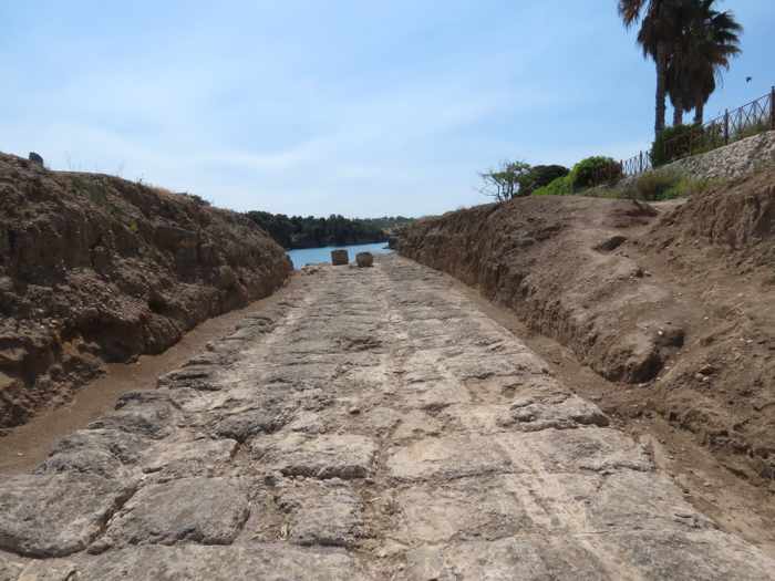
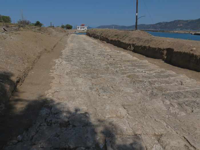
Looking along a section of the ancient Diolkos track, a stone-paved slipway once used to move boats overland across the Isthmus of Corinth. This section of the historic track is situated only a few meters from the edge of the Corinth Canal, which is partly visible in the upper right corner of the photo.
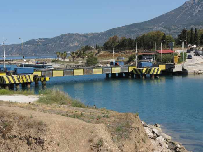
Marvels of maritime travel & transport: We have seen — and driven over — the world-famous Corinth Canal numerous times, but this daytrip marked our first opportunity to cross the 129-year-old waterway on a submersible bridge, something we never even knew existed. (Our previous canal crossings had been on the regional motorway and local road bridge, the same routes on which most tourists pass over the historic canal in excursion buses or rental vehicles.)
Another first, for us, was seeing a remarkable unearthed section of an overland track that was used to move cargo ships for hundreds of years long before the canal was constructed.
The Diolkos is a stone-paved road that enabled boats and transport ships to cross the Isthmus of Corinth — a 6 km wide stretch of flat land separating the Gulf of Corinth to the north from the Saronic Gulf to the south — instead of sailing the substantially longer and potentially perilous sea route off the Peloponnese coast.
This Google map pinpoints the submersible bridge near the Diolkos track, our first stop on a daytrip from the city of Loutraki to several historic attractions in the Corinth area of the Peloponnese
Grooves in the stone pavement are the ancient tracks that boats were dragged along from one gulf to the other
A marvel of engineering for its time, the Diolkos is believed to have been constructed in the early years of the 6th Century BCE, and operated from around 650 BCE to 50 CE. The track extended for as long as 8 kilometers between the two gulfs, and varied in width from 4.5 to 6 meters in most places, and up to 10 meters near each gulf coast. Boats would be hauled from the water on wooden rollers, then loaded onto special wheeled vehicles that animals would pull along grooves in the track. To make the load lighter for carriage on the track, the vessel’s cargo would be unloaded and transported to the other gulf separately, by road, while the boat was slowly dragged down the Diolkos. Once the ship was refloated in the gulf on the opposite side of the isthmus, its cargo would be reloaded and the boat would resume its voyage.
The Diolkos was a costly shortcut for shipowners, who paid steep fees for the slipway transit service, and it gradually fell out of favour as sailing firms began acquiring larger ships that could more safely navigate the seas off the Peloponnese.
We felt it was definitely worthwhile making a short stop at the Diolkos to appreciate the ancient engineering achievement and contemplate the incredibly difficult and demanding physical labour that would have been required to move heavy boats along the passageway.
As for that submersible bridge we crossed to reach the Diolkos, we didn’t know how it worked until long after we got home from our trip, when I found a YouTube video which I have posted below. We had thought it was a type of drawbridge that would swing to one side to let boats pass but, as the video shows, it actually drops deep into the water channel, then quickly rises back into position once ships have entered or exited the canal.
We didn’t get to watch the bridge in action because the canal had been closed to traffic at the time, still undergoing restoration work to repair extensive damage caused by a series of landslides in late 2020 and in 2021. It reopened in July 2022 for a few months of seasonal operations before shutting for a scheduled second phase of repairs that will be performed during the late autumn and winter.
This two-lane vehicle bridge, at the west entrance to the Corinth Canal, submerses to let boats and ships pass through the canal. It’s located close to a segment of the Diolkos trackway. We crossed this bridge en route from Loutraki to the Diolkos track during a May 2022 daytrip in the Peloponnese. Another similar bridge is situated at the east mouth of the canal.
We didn’t get to see, in person, how the submersible bridges at the Corinth Canal work, because the canal had been closed to boat traffic at the time of our visit. But this interesting 3-minute video, by OurTour Blog, shows one of the bridges in operation.
Learn more about the Diolkos and Corinth Canal
For further historic insights and background information on both the Doilkos track and the Corinth Canal, complete with photos and maps, have a look at these excellent articles:
♦ Corinth Canal Doilkos on Sailing Issues, a website focussed on marine navigation and sailing holidays in Greece, Croatia and Turkey;
♦ The Greek Reporter story Greece’s Corinth Canal closes again until next summer, published October 4, describes the landslides and restoration work that forced the canal to close until July of this year. The report also includes a local news video showing the rockfall damage.
This 3-minute National Geographic video shows stunning aerial views of the canal, including scenes of a large cruise ship navigating the narrow passageway
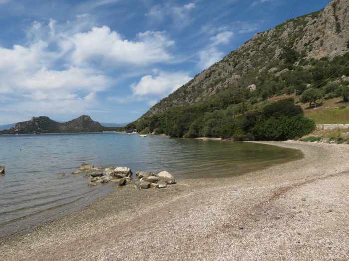
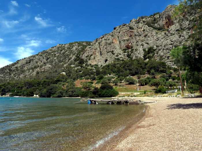
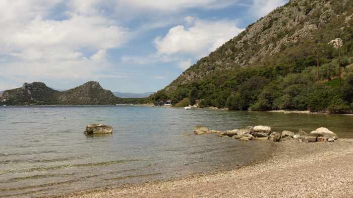
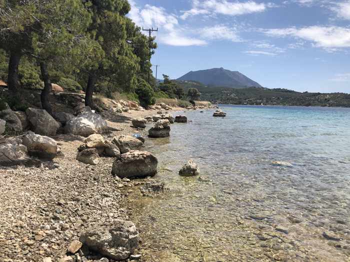
A look at two unique places where visitors to Loutraki can sunbathe, swim and enjoy beautiful scenery within a 20 kilometer drive of the city
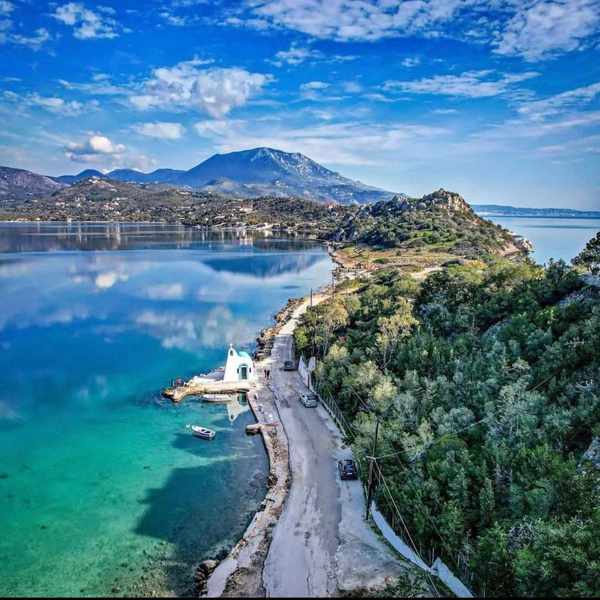
Encircled by pine forests, Vouliagmeni Lake is a salt-water lagoon where visitors can swim and sunbathe on sandy beaches and enjoy refreshments at tavernas along the shore.
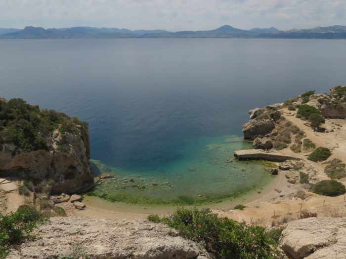
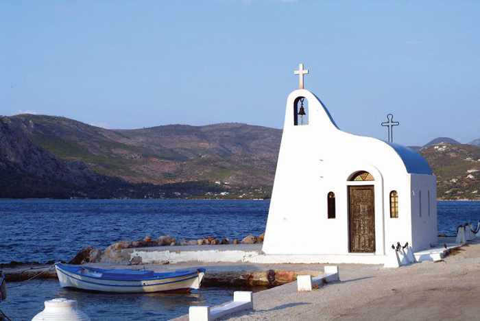
At the Sanctuary of Hera, visitors can explore an archaeological site, swim and cliff jump at a small beach below the ruins, then watch the sunset from a 125-year-old stone lighthouse perched high above the Gulf of Corinth
Into the Corinthian countryside: Sunshine, light clouds and temperatures in the mid-20s Celsius prevailed on our first full day in Loutraki in May. It was perfect weather for a drive through the Gulf of Corinth countryside to visit two of the area’s noteworthy attractions, Vouliagmeni Lake and the Sanctuary of Hera.
First stop was Vouliagmeni Lake, about 15 kilometers from the city. (Like many places in Greece, it is known and referred to by a variety of names, including Limni Vouliagmeni, Lake Ireon, the Heraion Lagoon, and the Blue Lake. To add to possible confusion, there’s another beautiful body of water named Vouliagmeni Lake that is also well-known by Greeks and tourists alike; that one is situated on the Athens Riviera.)
Surrounded by pine tree forests, rolling hills and steep rock slopes, the Vouliagmeni near Loutraki is an oblong-shaped salt-water lagoon connected to the Gulf of Corinth by a narrow channel. The lake is roughly two kilometers long and 1 kilometer wide, and its waters reach depths up to 40 meters. With sandy beaches extending across shallow stretches of its shore, and several tavernas and beach cafes located at varying points on the lakefront, it’s quite a popular daytrip destination for people seeking relaxation or fun in the summer sun — seasonal activities such as snorkeling, water skiing and wakeboarding, as well as cycling and hiking tours, are available at the lake.
Surprisingly, few other people were around when we were there, though that may have been because it was a Tuesday morning, and since we spent most of our time walking around and sitting in the sun on the northeast shore, near Taverna Hera, one of the lake’s handful of restaurant venues. There may have been more people at beachfronts on the southwest shore around Ypanema Seaside Food & Drink, or near the picturesque blue and white waterside chapel dedicated to Agios Nikolaos. Still, there was barely any traffic in the area, so it was remarkably quiet.
Above, photos we shot from the lakeside near Taverna Hera
Above, three views from the lake’s north shore
Above, two photos of the charming Agios Nikolaos chapel on the shore of Vouliagmeni Lake. The images were shared on the social media pages for Ypanema Food and Drinks, one of the lake’s top beach venues. More photos of the lake and the restaurant’s beachfront facilities can be seen on the @ypanemaloutraki page on Instagram.
This aerial film by Dronetube_GR runs nearly 4 minutes and tours viewers above the lake, its beaches and the channel to the gulf
Please click on the link below to read about our visit to the Sanctuary of Hera on page 2.
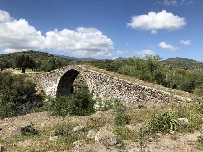
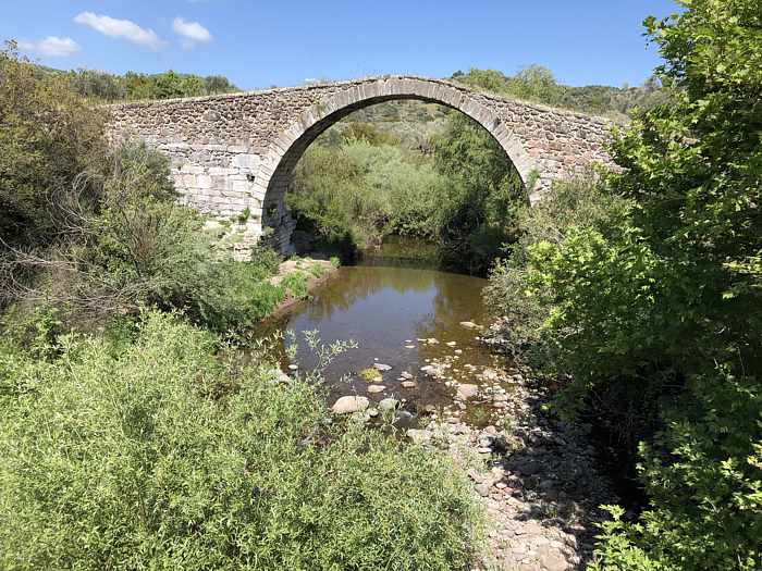
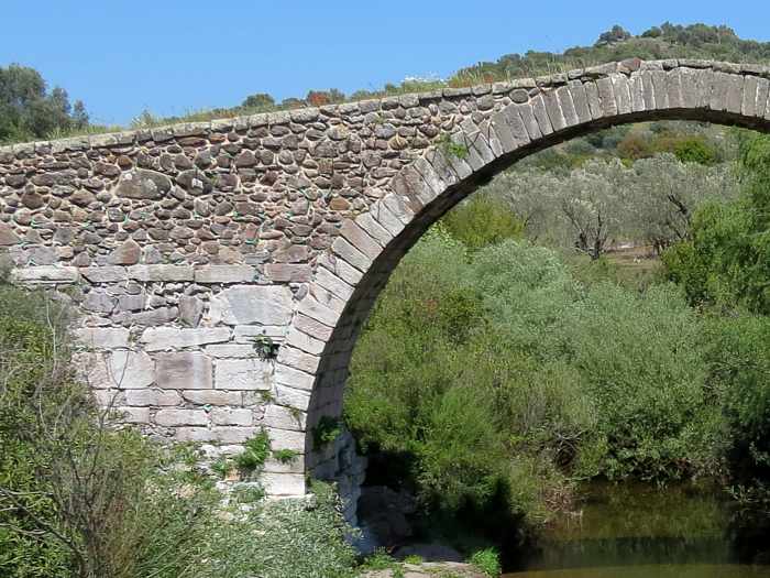
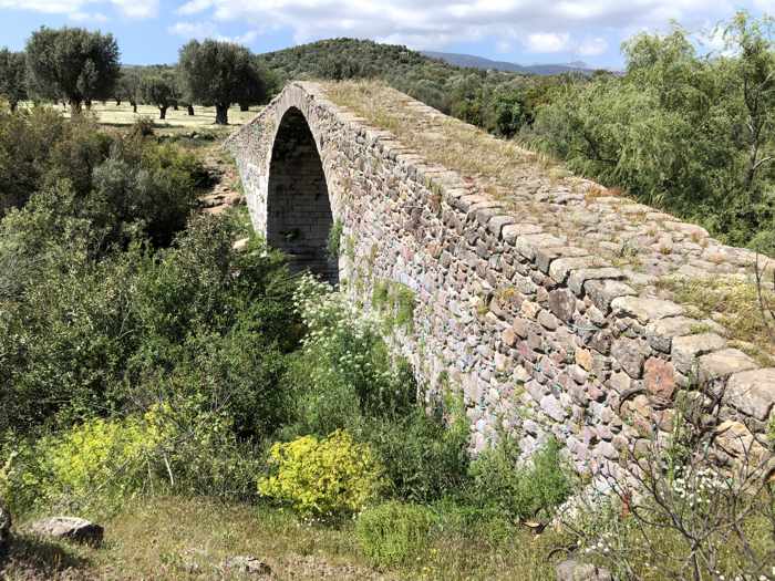
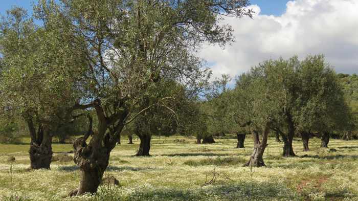
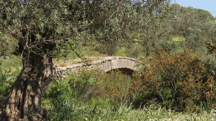
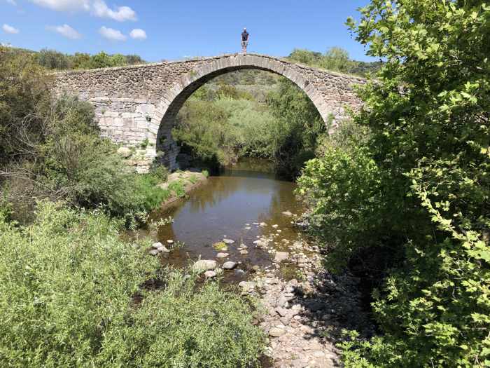
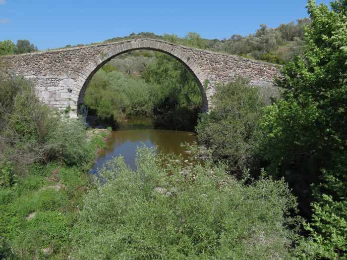
The arched stone Kremasti bridge spans a stream in bucolic countryside near the town of Agia Paraskevi on Lesvos
Walking back centuries: Unlike the other two tourist couples that showed up within moments of our own arrival, we did cross the Kremasti bridge when we got to it.
We couldn’t pass up the rare opportunity to walk on a hand-built stone viaduct that may have been built as long as 600 years ago. Rare for us, because bridges even just a century old are few and far between back home in Canada, so crossing an ancient span isn’t something we can do any old day of the week.
However, walking on medieval bridges might be something those other people can do wherever they live, which would explain why they didn’t share our enthusiasm to get up close for a better look at Kremasti. The two women from the first car strode to the edge of the olive grove at the north side of the bridge for a brief look-see, then promptly drove off in the direction of Stypsi village. The driver of the second vehicle walked only a few steps from his car to snap photos — from a spot on the road that didn’t offer particularly good views of the monument standing 30 meters distant. His passenger didn’t even get out; she seemed more interested in something on her cellphone. Photo-taking finished, the man climbed back into the driver’s seat, made a three-point turn, and drove off the way they had come.
In less than four minutes tops, both couples had arrived and departed, probably adding a “been there, seen that” checkmark to their lists of historic sites they had “visited” on Lesvos.
We didn’t mind having the old bridge all to ourselves; we got to appreciate its elegant architecture and examine its impressive masonry and engineering without getting in the way — or in the background — of someone else’s selfie. And on such a sunny and warm spring afternoon, who wouldn’t want to enjoy the fresh air and quiet beauty of the countryside, take a stroll through the lovely olive grove, and imagine how crucial the bridge would have been for regional travel in the centuries before motor vehicles? Oh, right — we can think of at least four people who would prefer not to! But we weren’t keen to hurry back into the car to see more of Lesvos through the windshield and side windows. We would get to do that during the drive back to our hotel in Molyvos later in the day. Instead, we took a nice, slow walk across 600 years of Lesvos history, and savored the experience of simply being there for awhile. Besides, we were on Lesvos, where rushing around just isn’t the way to see and enjoy the subtle beauty and character of the island.
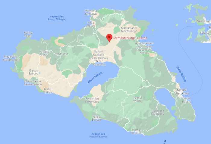
This Google map pinpoints the Kremasti bridge location in northern Lesvos, approximately 3 km northwest of the town of Agia Paraskevi.
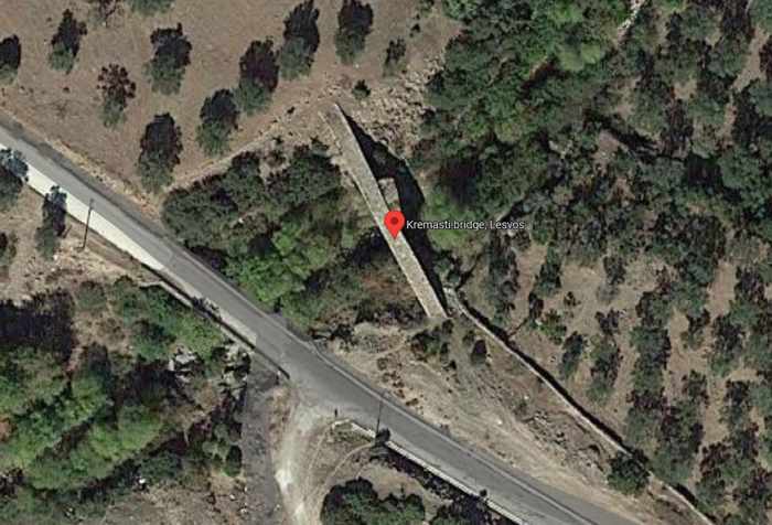
This Google satellite image shows the historic bridge and the modern-era road that carries motor vehicle traffic through the countryside of rolling hills to Stypsi village.
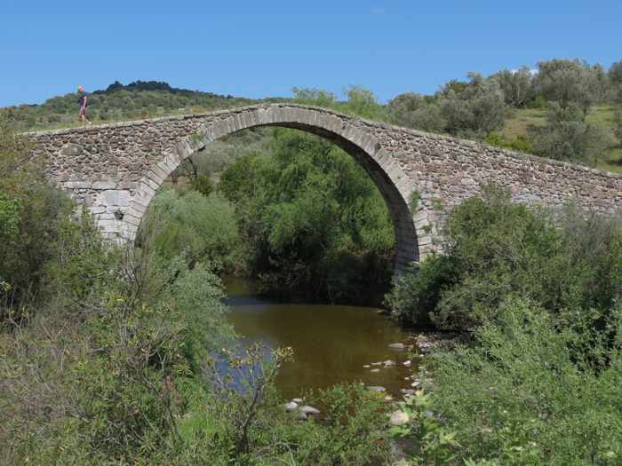
Our travel materials and guidebooks didn’t provide much information about Kremasti. Most said basically the same things: it’s “the largest and best-preserved medieval bridge in the eastern Aegean” (to quote our 4th edition copy of The Rough Guide to the Dodecanese and East Aegean Islands); it is widely believed to be have been built sometime during the period the Gattilusio family of Genoa controlled Lesvos (1355 to 1462); it crosses a stream which flows into the Tsiknias River; and it stands 8.5 meters tall at its highest point. (Curiously, no further dimensions, such as the length and width of the span, were described in any of the publications).
When we searched online for more details on the bridge’s history, we discovered that some websites dispute the date of construction, saying architectural details suggest Kremasti may have been built more than 100 years after the Gattilusio era, most likely during the 16th Century. Some sources also mentioned that, according to local legend, the master builder buried his wife’s body into the bridge foundations.
We didn’t have any luck learning how the bridge got its name, but we did find some insight in The bridge of Kremasti, an interesting article written by Perris P. Vougioukas and published in 2015 by the local news and information website Agia Paraskevi Only.
Besides discussing some of the history and legend behind the bridge, Vougioukas provided some dimension statistics that we couldn’t find anywhere else. Like other sources, he noted the Kremasti arch reaches a maximum height of 8.55 meters, but he furnished additional measurement facts: the bridge opening is 14 meters, while the span’s cobblestone walkway extends for approximately 50 meters, and is 3.5 meters wide.
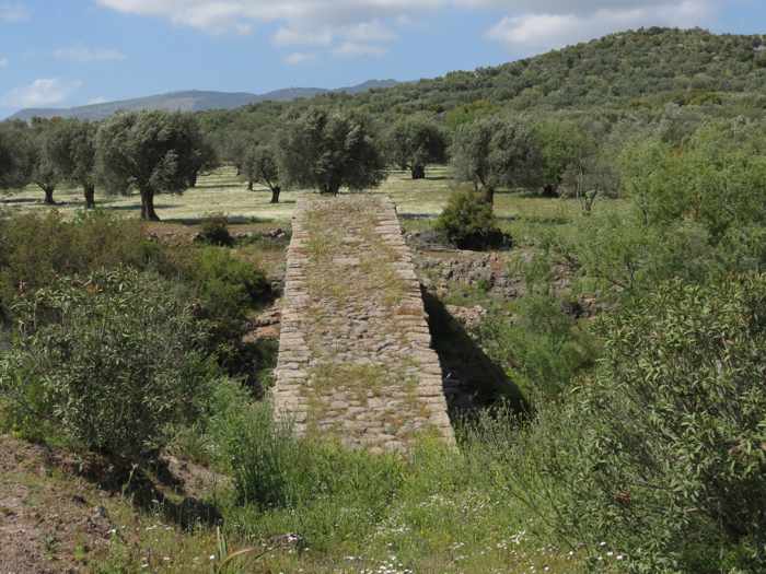
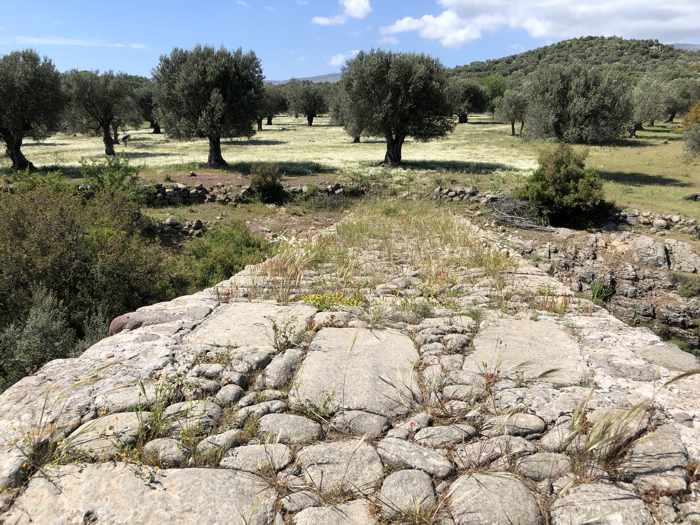
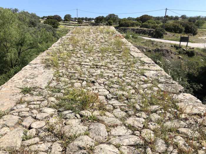
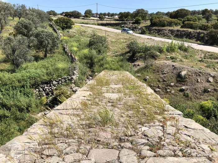
We had been curious about the bridge length because we wanted to know how far into the past we had wobbled along the uneven surface, where weeds and grasses sprout from cracks and spaces between the stones. Unfortunately, we couldn’t cross the entire span — a section of wire fence blocked access to and egress from the north side of the bridge. We didn’t realize this until we were almost all the way up and over the arch, having begun our crossing from the south. Clambering over or around the barricade would have been awkward and unsafe, so we wisely retraced our steps. Although it was a bit disappointing to wind up just one or two steps shy of a complete crossing, we got to spend twice as much time on the bridge, and enjoy the different views in each direction.
(We couldn’t understand why the fence had been installed; there weren’t any signs indicating it was off limits, and none of our tourist guides warned that walking on the bridge was either unsafe or not permitted. We wondered if the owners of the olive grove simply didn’t want people like us ambling around their trees or having picnics on their property! Or perhaps they had blocked the path to prevent their sheep or goats from crossing onto the bridge and possibly falling into the stream. If any of our readers know the answer, please share it with us!)
Our visit to Kremasti bridge took place during a day-long drive to explore sights and villages in northern Lesvos. We also could have seen the bridge by walking, since there are well-established trekking routes in the area, but we chose to leave long hikes for our next trip to Lesvos. For any of our readers who might be interested in such a scenic walk during an upcoming trip to Lesvos, here are links we had bookmarked for two websites that provide detailed directions for walking routes that pass the bridge:
♦ the Napi – Kremasti bridge route on the AllTrails website
Below are a few more of our photos of the bridge and its surroundings:
The three photos above show the bridge as we approached and began crossing the span from its southern side
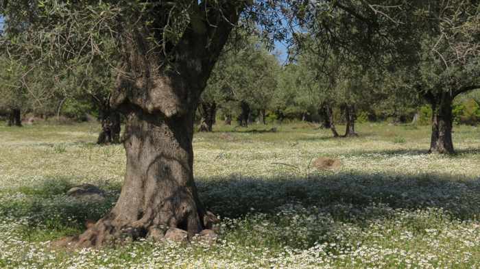
The view toward the olive tree grove at the north end of the bridge. Even from this point, we couldn’t see the thin wire fence that blocks access to the grove.
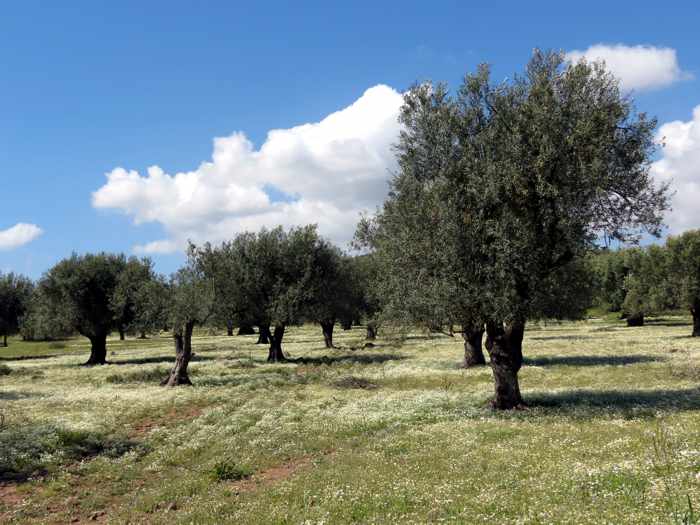
The three photos above show views of the olive tree grove at the north end of the bridge. The ground was carpeted with tiny white spring flowers.
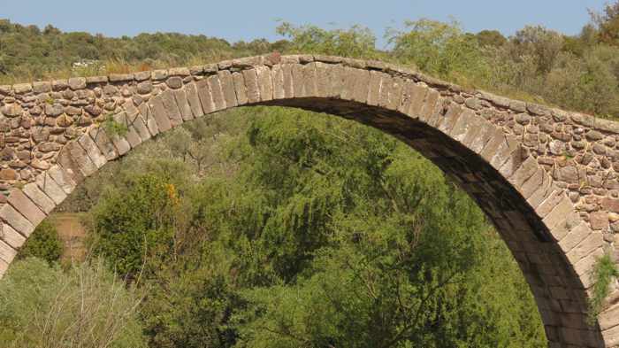
From the edge of the olive grove, a glimpse of the bridge’s arch
The stream beneath the bridge is a tributary of the Tsiknias River, which flows into the Gulf of Kalloni
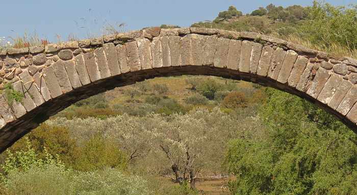
Above: two views of the arched stone span
The wire fence that blocks passage at the north end of the bridge is partially visible in this photo.
Above: two views during our walk back to the southern end of the bridge
One final look at Kremasti, seen from the modern bridge that carries motor vehicle traffic across the stream
This is the lead video in a Central Macedonia tourism campaign that invites visitors to come “do something great.” The promotion includes four additional short films (see below) that will tempt travellers with fabulous photography of great things they can see and do in the region.
Greatness abounds: It’s widely known as the historic home of its king, Alexander the Great, in ancient times, but the mainland Greece region of Central Macedonia wants more people to discover that it’s also an incredible place for tourists to visit 365 days a year.
The region already attracts more than 7 million visitors annually, drawn to such internationally-known destinations as the city of Thessaloniki, the holy monasteries at Mount Athos, the beach-blessed Halkidiki peninsulas, and the tallest peak in Greece, Mount Olympus.
But Central Macedonia isn’t even on the radar for countless other people who have been to Greece, or who might be planning to visit, and aren’t aware there’s so much more to the country than Athens and the islands of Mykonos, Santorini, Rhodes. Crete and Corfu. To show those potential visitors why they should give Central Macedonia a closer look, the region has produced five promotional videos that highlight the vast array of vacation experiences available for all types of travellers and their holiday activity preferences.
With spectacular cinematography, the 2-minute videos showcase some of the region’s magnificent landscapes and natural scenery, exciting outdoor sports and adventure activities, arts and cultural attractions, beautiful beaches, and its traditional and contemporary cuisine. The sheer breadth of the region’s natural and human-created wonders may be an eye-opening surprise to people who aren’t familiar with this part of Greece.
The “Do Something Great” video, posted above, is the primary film for the tourism campaign. Published on YouTube and shared on social media platforms, it provides a general cinematic overview of Central Macedonia’s appealing travel attractions, while four other videos, posted below, shine a spotlight on destination features that appeal to specific visitor pastimes:
♦ Taste the Great! whets viewers’ appetites with images of mouth-watering traditional and contemporary cuisine;
♦ Sun the Great! displays brilliant scenes of gorgeous coastal landscapes to show that “nothing beats a sunny day on the beach”;
♦ Experience the Great! profiles some of the thrilling outdoor activities that sports enthusiasts can pursue, such as: mountain biking; skateboarding; surfing; rock climbing; scuba diving; alpine skiing; boating; and river rafting; and
♦ Admire the Great! spotlights cultural attractions, including: art galleries; museums; historic sites; monuments; memorials; churches, temples and monasteries; and music entertainment.
Each of the videos is well worth watching, and the full series takes only 10 minutes to view. We don’t have a favourite to recommend; although we’ve notched half a dozen viewings for the food film, and at least two apiece for the rest, we enjoyed them all.
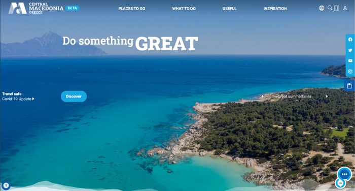
If you’re interested in learning more about the region after watching the clips, you’ll find the Central Macedonia travel website (pictured below) is a great place to start your research and holiday planning.
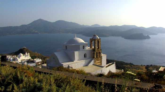
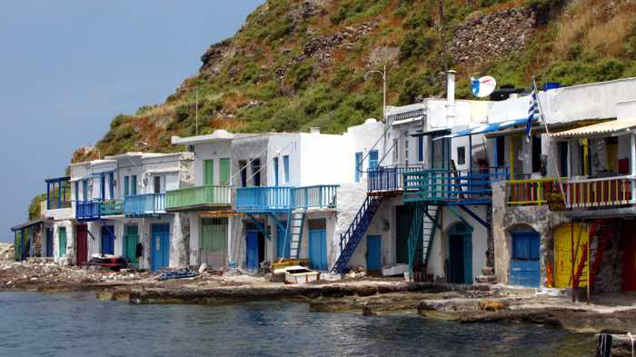
Our own photos of three Milos island landmarks: the Panagia Thalassitra Church at Plaka village (top), colourful boathouses at the Klima fishing settlement, and the surreal coastal rock formations at Sarakiniko
Milos’s moment: 2021 has been quite the momentous year for Milos, with unparalleled international publicity planting the island firmly into the minds and onto the bucket-list travel maps of millions of holiday-hungry people around the globe.
We told you this was coming.
In our blog post Much ado about Milos four years ago (August 2017, to be precise), we described a noteworthy surge in interest in Milos, and we predicted its popularity would soar.
This year, despite the Covid-19 pandemic, that’s exactly what happened: Milos was the Greek island people everywhere were taking note of, talking about, and visiting in person either for vacations or for corporate marketing photography and film shoots.
It wasn’t just travel blogs, vlogs and websites singing the island’s praises — Milos was the focus of attention in advertising campaigns for clothing, coffee and luxury goods; social media posts by music and television stars; architecture and design publications; luxury hotel review websites; business and lifestyle magazines, and more.
Once a hideaway for pirates, the coastal cliffs and caves at Kleftiko are now a popular stop for Milos sailboat tours
Among the Milos milestones of 2021:
♦ Readers of the most-read American travel magazine voted Milos the “No. 1 island in the world” as well as best island in Europe;
♦ One of the world’s best-selling music artists visited in the spring and posted photos from the island’s capital and one of its picturesque fishing villages to Instagram, where his account is actively followed by more than 200 million people;
♦ Its exquisite coastal scenery stole the show in major promotional campaigns for three of the world’s pre-eminent luxury fashion brands;
♦ The island played a starring role in a television advertising campaign for a popular coffee retailer;
♦ Architecture and home design magazines drew attention to Milos with profiles of a contemporary “corral” residence ingeniously built to blend seamlessly into the island landscape;
♦ Hotel review websites trumpeted the arrival of two brand-new luxury accommodations that opened in June;
♦ International publications and leading travel blogs published laudatory profiles of the island’s appealing scenic attributes and attractions, and
♦ top travel vloggers enthralled YouTube watchers with videos spotlighting key Milos attractions and the splendid natural scenery.
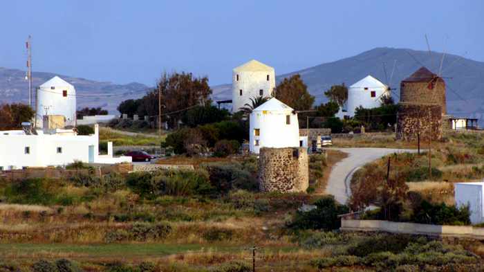
A cluster of windmills near Tripiti village. Some have been converted into holiday rental accommodations.
To see how and where Milos has made such an indelible impression this year, keep scrolling down through this post, and then Part 2 and Part 3, to view a wide-ranging collection of the feature stories and videos of the island that have appeared in mainstream and social media this year.
Below you’ll see the magazine whose readers chose Milos as best island in the world, along with Milos photos shared on social media by two top celebrities, plus island scenes from the major fashion and retail marketing campaigns that starred Milos.
In Part 2, we take a look at what writers said about Milos in their reports for travel magazines, blogs and websites, as well as in articles published by business, fashion, lifestyle and hotel periodicals.
Part 3 is a collection of Milos videos that were released in 2021 by filmmakers and international travel vloggers.
The photos and video images in our three-part series will show you what all the Milos fuss is about — and why so many travel writers and videographers think you should pay it a visit soon.
Besides screenshots of the articles and reports, we have provided links to the publications and video producers so you can read and view more of Milos, and obtain additional information to decide if it’s the right place for you and your family to spend some vacation time. With scores of enticing photos and videos plus a plethora of practical information and travel tips, the links will be useful to bookmark for travel inspiration and holiday planning.
Given the vast range of insights, opinions and perspectives provided by these different resources — including tips on times of day to see certain places, how to get there, what not to miss or what to to know before you go — this compendium could well become your ultimate travel guide to Milos.
But don’t wait too long! As some of the writers and vloggers point out, the island’s popularity is skyrocketing — so it’s best to see this off-the-beaten-path gem soon, before it becomes a busy mainstream holiday destination.
— Milos on magazine covers —
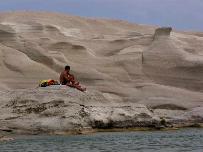
Photos of Sarakiniko — the Instagram-famous “moonscape” beach and coastline on Milos — were prominently featured on the covers of Thalassea and Travel + Leisure magazines
Milos received cover treatment from Thalassea, the official magazine for Greek ferry company Hellenic Seaways, as well as Travel + Leisure, the most widely-circulated American travel magazine with nearly 5 million monthly readers. The front pages of both featured picture’s of the island’s renowned cliff-jumping spot, Sarakiniko.
Inside Thalassea, a two-page aerial photo of Sarakiniko illustrates the magazine’s “Reasons to Go” to Milos article. “One look at Sarakiniko beach and you will be smitten for life,” the text reads, adding: “this is an island far out of the ordinary.”
Meanwhile, the cover image for the October 2021 Travel + Leisure acknowledged Milos’s great success in the magazine’s Annual Reader’s Awards, which voted Milos as not only the best island in Europe, but also the No. 1 island in the entire world. (More on those accolades below.)
— Travel + Leisure readers’ best island awards —
Travel + Leisure readers honoured Milos by voting it the No. 1 island in the world this year
We weren’t surprised when we learned Milos has been voted top island in the world by readers of Travel + Leisure magazine. We’ve been there twice, and know from personal experience why people enjoy it so much.
The voting took place from mid-January to early May of this year, and the magazine said participating readers “rated islands according to their activities and sights, natural attractions and beaches, food, friendliness, and overall value.”
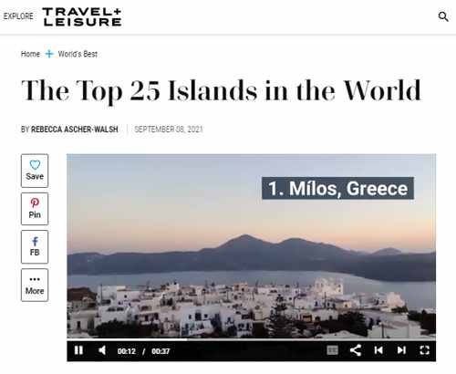
To find out why Milos nabbed top honours, take a look at the short blurb in the T + L article The Top 25 islands in the world.
Milos had good company in the rankings, by the way. One of its close neighbours, Folegandros, earned the No. 2 spot, while perenially-popular Santorini took 13th place.
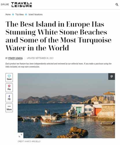
Milos was “a closely guarded utopia,” writer Stacey Leasca says, until word got around that Travel + Leisure readers had voted it the best island in Europe and the world
In the wake of announcing that its readers had voted Milos as best island in Europe, and in the world, Travel +Leisure published a report in which writer Stacey Leasca recounted her 3-day visit there in June.
Upon arrival, she recalls, it was “easy to see why previous travelers and locals alike would want to keep this place under wraps. Its rocky shoreline gives way to some of the most pristine crystal-blue waters I have ever laid eyes on. Its landscape is one sweeping hillside after another, dotted only by sparse vegetation, white-washed homes, blue-roofed churches, and a rogue goat or two. And its food is divine.”
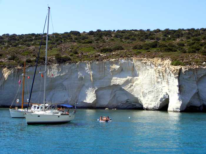
Though their visit lasted only 72 hours, Leasca and her travel companion managed to see numerous key attractions including the port town of Adamantas, the villages of Plaka and Klima, the beaches Sarakiniko and Papafragas, the ancient catacombs, and others.
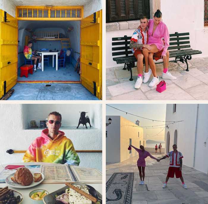
In photos shared with his 200 million fans on Instagram, singing superstar Justin Bieber is seen in a private boathouse dining room at Medusa cafe-restaurant in Mandrakia (left) and with his wife, Hailey, in Plaka village
Popular entertainers, movie stars and professional athletes wield incredible influence over consumer spending habits, which is why companies pay celebrities big bucks to endorse or advertise their products. We can’t help but speculate on the value of the publicity that Milos received — for free –when international music superstar Justin Bieber shared photos from the island on his Instagram page in late June. Considering that the Canadian-born singer counts more than 205 million followers on Instagram, he brought Milos to the attention of an enormous audience of potential travellers, many of whom had probably not even heard of the island before.
Bieber’s private yacht cruise to the Cyclades islands was reported by media around the world, with some of the Greece-based reports about his Milos visit including:
We think Bieber deserves some credit if there’s any bump in tourist traffic to Milos in the next year or two, and we’re pretty certain Medusa restaurant will top traveller lists of must-visit places to eat, as well — thanks to the Bieb’s headline-making lunch there. But he can’t take all the credit: Medusa gets more shout-outs from travel bloggers and vloggers in some of the reports and videos you’ll see below.
Between June 26 and 29, the singer posted posted from Milos and the Cyclades to the official Justin Bieber Instagram page, while he shared two images on the Justin Bieber Facebook page — which has 91 million followers — on June 28 and 30.
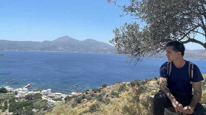
— Pedro Alonso’s Milos visit —
Actor Pedro Alonso gazes across Milos from a hillside vantage point (top) after reading a monologue from a Spanish play in the island’s ancient open-air theatre (seen in this screen capture from an Instagram video of his impromptu performance).
About a week after Justin Bieber moved on from Milos, popular Spanish actor Pedro Alonso arrived for his Greek holiday. Alonso is perhaps best known for playing the character “Berlin” in 36 episodes of the Netflix television series Money Heist, from 2017 to 2021.
On July 8, Alonso posted a video and several photos shot on Milos to his Instagram, which has more than 9.1 million followers. The video shows the actor at the island’s Ancient Theatre, reciting a monologue by the character Rosaura in the Pedro Calderon de la Barca dramatic play La vida es sueño. The photos included a shot of Alonso sitting at a lookout spot near the theatre, and a view of the seaside village of Klima.
The acting monologue video and five photos can be viewed on the pedroalonsoochoro page on Instagram.
— Fashion campaigns filmed on Milos —
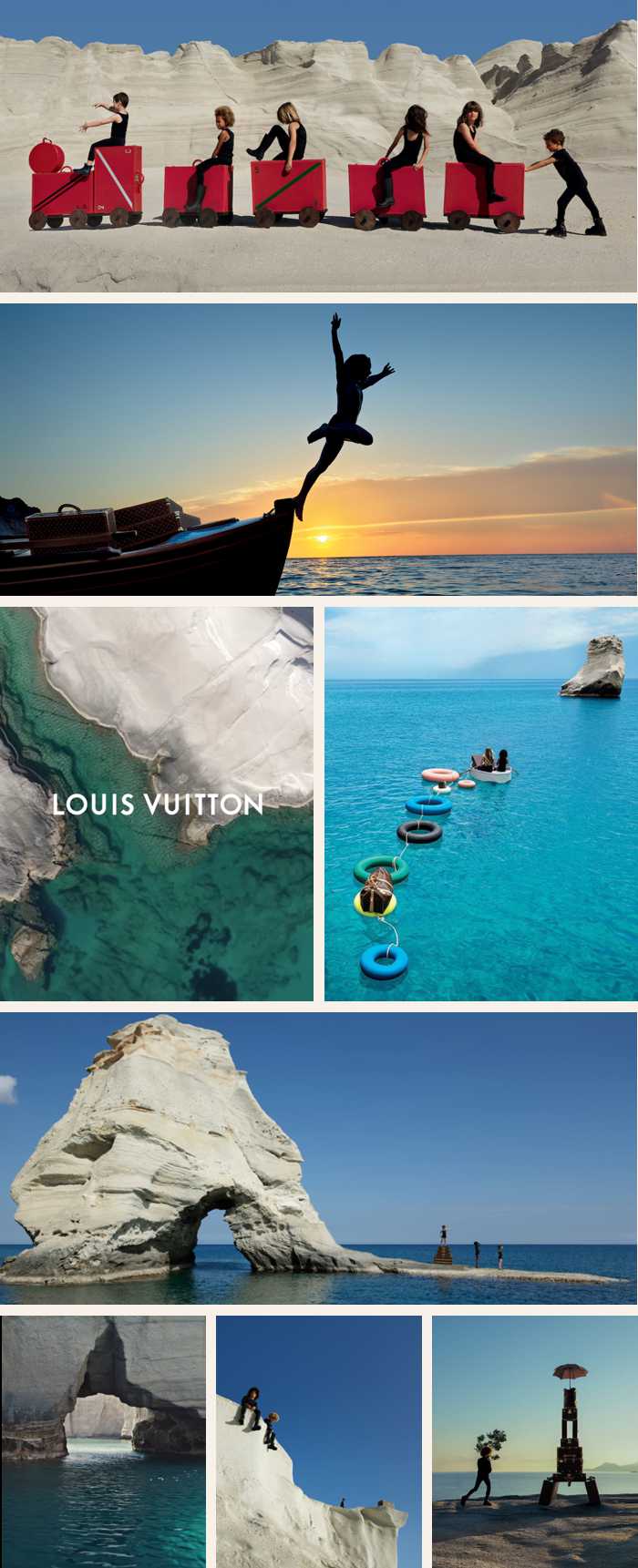
A Louis Vuitton promotional campaign spotlighted scenery on the Sarakiniko and Kleftiko coasts of Milos
Milos was one of two “dreamlike settings” that the iconic luxury brand Louis Vuitton selected as a filming location for its 2021 Towards a Dream advertising campaign (the other site was Jordan). Photo shoots took place at Sarakiniko beach and the Kleftiko coast, where photographer Viviane Sassen captured “spirit of travel” images that the company calls “an evocative ode to the inner child, set free in a reverie of otherworldly beauty and infinite possibility.”
“Rich in ancient history, the Greek island of Milos beckons to a group of children, inviting them to play among its stark shores and pristine waters. With their innocent curiosity, their silhouettes emerge from the landscape to convey a limitless sense of optimism and freedom,” says a description of the photoshoot theme.
You can view the full-size promotional photos and a short video at the Towards a Dream campaign page on the Louis Vuitton website.
Photos and videos also were posted between September 16 and 19 on the official Louis Vuitton Instagram page, which boasts more than 46.4 million followers.
Photos and a link to the Towards a Dream campaign also were posted September 17 to the Louis Vuitton Facebook page, which counts more than 24 million followers.
Scenes from Plaka, Sarakiniko and Mandrakia figure prominently in photos shot on Milos for the Dior 2022 Cruise Collection (above), while a 3-minute video (below) offers a behind-the-scenes look at the Dior Magazine photo project. It includes commentary by some of the photographers along with views of magnificent Milos landscapes and the Temple of Poseidon at Sounion.
Another legendary fashion house, Dior, chose Milos as one of the principal shooting locales for its 2022 cruisewear collection and Dior Magazine Issue 36 (some filming also took place in Athens and at the historic Temple of Poseidon at Cape Sounion).
The cruise fashions were designed by Maria Grazia Chiuri, who found inspiration in “classical Greece and mythical female goddesses and divinities.” It was only fitting, then, that Dior photographed its models at ancient Greek ruins and mesmerizing island landscapes.
For this campaign, Dior invited ten Greek photographers — Mara Desipris, Christina Dimitriadis, Marilia Fotopoulou, Efi Gousi, Maria Koutroumpi, Dimitra Lazaridou, Ria Mort, Lia Nalbantidou, Ioanna Sakellaraki, and Olga Stefatou– to capture their personal visions of the cruise collection’s apparel and accessories. You can read a description of the project and see some of the photos shot by all 10 women on the Captivating Visions page of the Dior website.
Campaign photos and videos also were posted in late November to the official Dior Instagram page, which has more than 38.3 million followers, and to the Dior page on Facebook, which reaches more than 18 million followers.
Milos also was the shooting location for HANRO’s spring/summer clothing campaign
Constant change and tumultuous current events have had a huge impact on society and individuals, leading many people to reassess their personal priorities and redefine what they consider quality of life. HANRO, a 130-year-old firm known for its fine men’s and women’s daywear, loungewear and nightwear, seized upon the global trend to “recharge” and “reset” when it chose Milos as the shooting location for its spring/summer 2021 fashion campaign.
“One place that is the perfect setting for ultimate relaxation and revitalizing the soul is in the Greek island of Milos,” says a description of the HANRO marketing program.
“Unassuming and sublime, [Milos] defies the forces of nature and shows us just how much beauty can emanate from constant change. Every gust of wind dances differently on the sea; every wave traces new patterns as it laps on the sand. Each ray of sunlight changes the kaleidoscope of colours and the spirit of nature. The soft sandstone and volcanic rock is constantly sculpted by the wind. Nothing is ever the same as the day before, and yet this transience harbors a great sense of calmness and strength. It teaches us to appreciate the here and now, to live in the moment, and to simply exhale and let go.”
In contrast to its dominant role in the Louis Vuitton images, the Milos scenery provides a much more subtle backdrop for photos of the HANRO models, but looks inviting nonetheless. Photos and a promotional video can be viewed on the Spring Summer 2021 campaign page of the HANRO website.
— Nescafe television ad —
Greek actor Giorgos Lianos appears in a television ad for Nescafe coffee
Milos was the sun-soaked filming location for the light-hearted Nescafe Greece television campaign “Make your summer count,” featuring actor Giorgos Lianos.
The ad was filmed at various locations across Milos, with Sarakiniko beach making the most appearances in the minute-long clip. And, yes, the commercial includes scenes of people jumping into the sea from the Sarakiniko cliffs while Lianos stands on the edge and watches, with a Nescafe frappe in hand.